

3 Things To Know:
- Showers and storms are expected on Tuesday, mainly between 1 PM and 9 PM.
- A few isolated severe storms with hail and gusty winds cannot be ruled out.
- Dry and pleasant weather returns Wednesday through Thursday, with rain possible again on Friday.
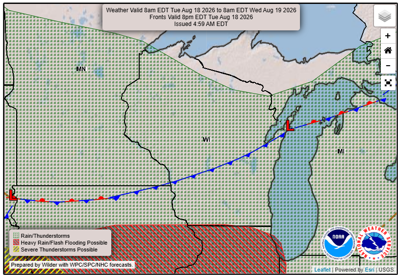
As we move into Tuesday, Southeast Wisconsin can expect a shift in weather patterns as a cold front approaches from the west. This afternoon, a ridge of high pressure is settling over the region, leading to mainly west-northwest winds. However, near Lake Michigan, an easterly lake breeze is developing, which may lead to slightly cooler temperatures.
The cold front currently extending from North Dakota is set to sweep through southern Wisconsin Tuesday afternoon and evening. This cold front will bring the potential for showers and thunderstorms, with the highest likelihood occurring between 1 PM and 9 PM. While widespread severe weather is not anticipated, a few strong storms could produce gusty winds and isolated hail.
“Stay weather-aware if planning to be outdoors Tuesday afternoon/evening.”
What to Expect
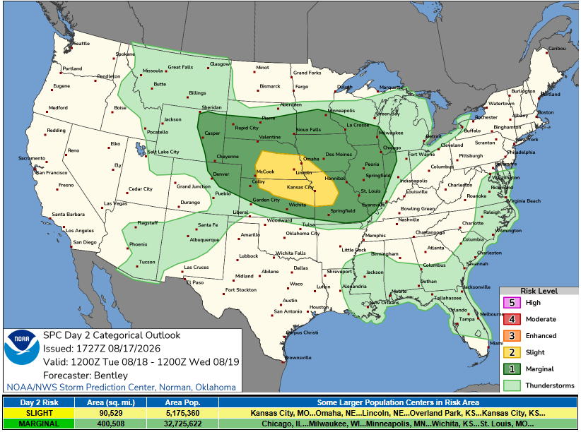
Tonight, lingering high pressure might bring some fog in the Wisconsin Valley, although dense fog is not anticipated. For Tuesday morning, there remain uncertainties regarding the development of showers or storms, with possibilities ranging from dry conditions to light precipitation moving in from the west.
Moving into Tuesday afternoon and evening, the chances for precipitation increase significantly as the cold front approaches. Meteorologists are currently estimating about a 60% chance for showers and thunderstorms in this window, contingent upon moisture and instability recovery during morning hours. The potential for isolated severe storms also remains under continued evaluation.
Looking Ahead
Once the cold front passes, conditions will dry out Tuesday night, leading into beautiful and pleasant weather on Wednesday and Thursday. As we head toward the weekend, the next round of rain and storm chances will arrive with another cold front on Friday. However, forecasters are optimistic about a return to nice weather over the weekend.
For updated forecasts where you live check out our Forecasts Page.
Source: NWS MKX Area Forecast Discussion, issued 2026-08-17T19:23:00+00:00.
