

3 Things To Know:
- Expect seasonably warm temperatures from Sunday into early Monday.
- There could be a slight chance of thunderstorms late Monday afternoon.
- Higher rain chances return to the area from Wednesday through Friday.
This weekend, we are looking at warm temperatures across Western Wisconsin, with highs creeping into the mid-80s by early next week. While we’re enjoying these summer-like conditions, there are some small rain chances to be aware of.
The Basics
As an omega block pattern influences the weather, we can expect above-normal temperatures along with limited chances for rain through Tuesday. The next few days will bring warm weather, making it a great time to enjoy outdoor activities.
Rain Chances This Weekend
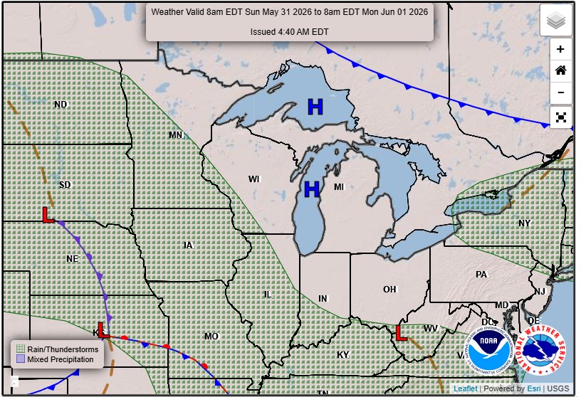
Small chances for showers and even thunderstorms may develop, particularly late Sunday night. The best likelihood for these showers is west of the Mississippi River, with chances ranging from 20% to 50% in some areas. Additionally, early Monday afternoon may bring an outside shot (10%) for storms, especially as some atmospheric instability moves into the region.
“…we cannot rule out occasional small chances for showers and thunderstorms.”
Looking Ahead
Temperatures will remain warm on Tuesday before a shift in weather patterns leads to higher rain chances starting mid-week. From Wednesday through Friday, expect increased moisture and shortwave activity, which will enhance the potential for thunderstorms.
As always, stay tuned for updates as we track these weather developments. For updated forecasts where you live check out our Forecasts Page.
Source: NWS ARX Area Forecast Discussion, issued 2026-05-29T19:34:00+00:00.
