
3 Things To Know:
- Scattered thunderstorms expected Saturday afternoon through Saturday night.
- Isolated storms may become strong, with damaging winds and hail as the main threats.
- Below normal temperatures arrive early next week with a chance for more thunderstorms Tuesday and Wednesday.
Weekend Thunderstorms
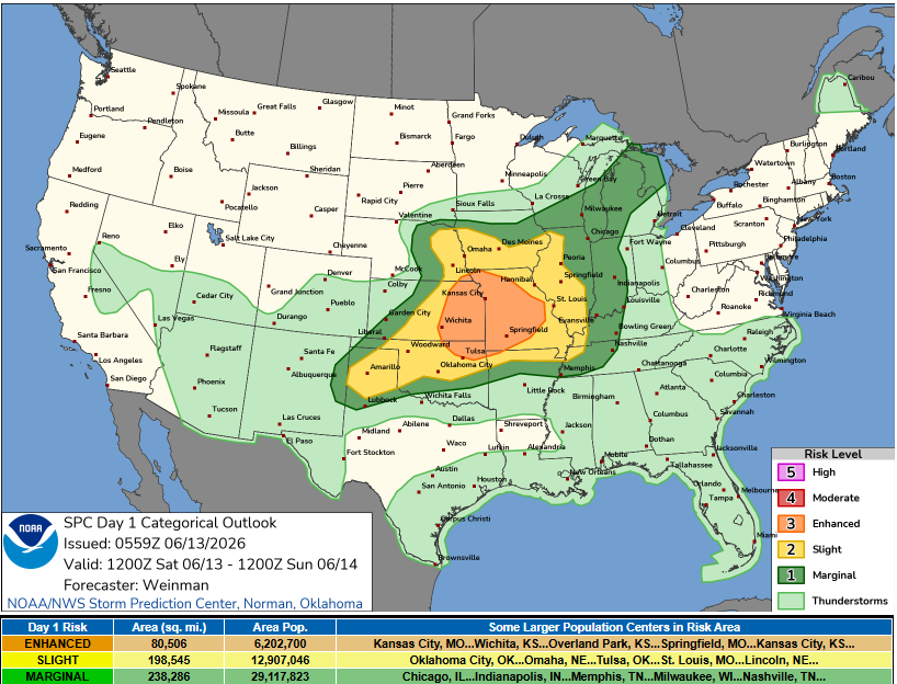
The latest forecast for Southeast Wisconsin indicates that we can expect a few rounds of scattered thunderstorms beginning Saturday afternoon and continuing into the night. As a low-level jet brings warm, moist air into the region, some isolated storms could potentially become strong to severe. While the overall severe storm threat is categorized as marginal, damaging winds and hail are the primary risks.
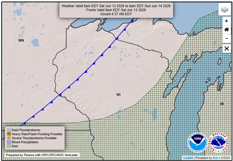
Expect rain chances to climb to 20-40% by early afternoon and reach 60-70% along and south of a line from Cedarburg to just south of Madison by late afternoon. It’s important to stay alert, as conditions may change rapidly.
Cooling Off Next Week
Following the weekend’s active weather, temperatures are projected to be below normal for early next week, with highs only reaching the upper 60s on Sunday. A series of shortwave troughs will linger in the area, bringing additional rain chances.
The first organized system will approach on Tuesday, creating a 60-80% chance of rain. Then, on Wednesday, another system may develop, bringing similar chances of rain and potential for stronger storms later in the day.
You can always track the forecast in your area by checking out our Forecast Page and check out our new WiscoNet page with great current weather from across the state as well as an almanac of highs, lows, precip totals and more!
Source: NWS MKX Area Forecast Discussion, issued 2026-06-13T03:42:00+00:00.