

A developing weather system could bring a strong to severe thunderstorm risk to parts of the Upper Mississippi Valley and Upper Midwest late Monday into Monday night, with Wisconsin potentially near the eastern edge of the threat.
3 Things To Know
- Strong to severe storms are possible late Monday into Monday night, especially from eastern Nebraska northeast into portions of the Upper Mississippi Valley and Upper Midwest.
- Wisconsin could be affected as storms move east, but the extent of the severe weather threat remains uncertain.
- The biggest question is instability. Wind shear may become favorable for organized storms, but it is unclear whether enough warm, unstable air will develop to support a more substantial severe weather threat.
The Storm Prediction Center has outlined a Marginal Risk, Level 1 of 5, for severe thunderstorms stretching from portions of the central Great Plains northeast toward the Upper Midwest in its Day 3 Convective Outlook.
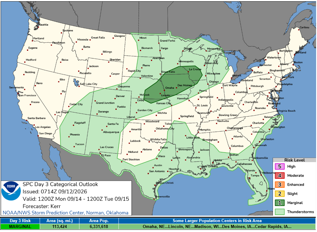
For Wisconsin, this is a forecast worth watching, but there remains considerable uncertainty about exactly how favorable the atmosphere will become for severe storms.
What Is Driving the Storm Threat?
A disturbance moving out of the northern Rockies is expected to accelerate northeast toward northwestern Ontario by late Monday night.
At the same time, a surface low is forecast to develop as south to southwesterly winds strengthen across the northern Plains, Upper Mississippi Valley, Upper Midwest and Great Lakes.
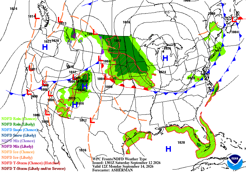
Those strengthening winds will increase vertical wind shear, one of the ingredients needed for organized severe thunderstorms.
A boundary lifting northward across the region could provide the focus for thunderstorm development, potentially extending from eastern Nebraska northeast toward the Upper Mississippi Valley.
The Big Question: How Unstable Does It Get?
While the wind pattern could support organized thunderstorms, the SPC says there is much more uncertainty surrounding instability.
Forecast guidance suggests cooler, more stable air could linger near the boundary. If that happens, storms may struggle to become strongly surface-based and the severe weather threat would remain limited.
If warmer and more humid air can move farther north than currently expected, however, the environment could become more supportive of stronger thunderstorms.
That uncertainty is an important reason the SPC currently has the region under only a Marginal Risk.
What This Means for Wisconsin
Wisconsin appears to be near the eastern portion of the broader area being monitored for thunderstorms Monday night.
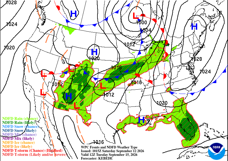
The more favorable setup currently appears to develop farther west across portions of the Plains and Upper Mississippi Valley before the system progresses toward the Upper Midwest and Great Lakes.
It is still too early to determine which parts of Wisconsin would have the greatest potential for stronger storms or what the primary severe weather hazards might be. The outlook does not specify a dominant severe hazard for Wisconsin at this stage.
The key over the next 24 to 48 hours will be watching how forecast models handle the northward movement of warmer air and whether sufficient instability can develop across the Upper Mississippi Valley and Wisconsin.
Bottom Line
There is a low-end but legitimate severe thunderstorm risk Monday into Monday night across portions of the Upper Mississippi Valley and Upper Midwest.
For Wisconsin, this is not a high-confidence severe weather setup yet. The ingredients for organized storms may be present, but whether the atmosphere becomes unstable enough to take advantage of them remains an open question.
Wisconsin Weather Now will continue to track the setup as Monday gets closer and the potential timing and areas of greatest concern become clearer. Check our Live Stream page for more.
