

An EF-3 tornado with 140 mph winds, giant hail and damaging storms swept across Wisconsin Monday, leaving widespread damage from the Northwoods to the Fox Valley.
An outbreak of severe thunderstorms swept across Wisconsin Monday morning, producing destructive winds, giant hail and a confirmed EF-3 tornado that carved a path through the Fox Valley.
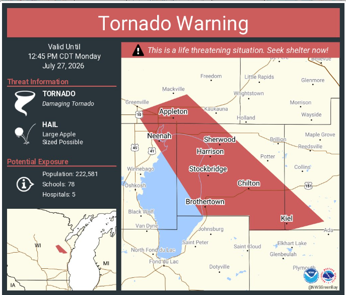
The most significant damage occurred in the Appleton and Menasha area, where National Weather Service storm survey teams have given the tornado a preliminary EF-3 rating with estimated peak winds of 140 mph. The tornado developed around 11:56 a.m. west-northwest of Appleton before tracking south through Fox Crossing and Menasha, damaging homes, businesses and countless trees before dissipating over Lake Winnebago around 12:22 p.m.
The National Weather Service said damage surveys are continuing, and the tornado’s final rating and track could change as additional assessments are completed.
Widespread Wind Damage Reported
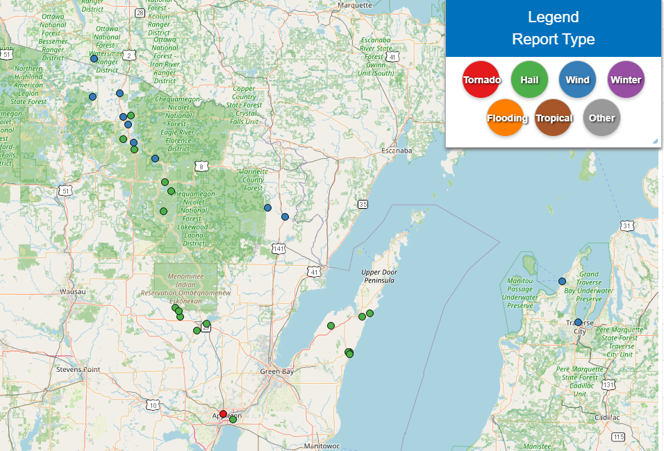
The storms first intensified across northern Wisconsin during the morning, with clusters of thunderstorms, including several supercells, moving southeast across the state.
Numerous reports of downed trees and power lines came from Vilas, Oneida, Forest and Marinette counties. Communities including Eagle River, Three Lakes, Hiles and Athelstane reported tree damage, snapped power poles and power outages as severe winds moved through.
Emergency managers reported snapped utility poles and uprooted trees along roads near Eagle River, highlighting the strength of the storms well before they reached eastern Wisconsin.
Giant Hail Pounds Communities
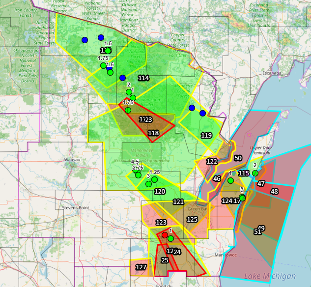
The storms also produced exceptionally large hail across northeast Wisconsin.
Some of the largest reports included:
- Shawano County near Gresham: hail estimated at 4.5 inches, roughly the size of a grapefruit.
- Shawano County near Belle Plaine: 3-inch hail.
- Door County near Sturgeon Bay: 3-inch hail.
- Kewaunee County in Algoma: 3-inch hail.
- Shawano County near Lyndhurst: 2.75-inch hail.
- Multiple reports of hail between 1.5 and 2 inches were received across Forest, Oneida, Vilas and Door counties.
Hail of this size is capable of causing significant damage to vehicles, roofs, windows and crops.
Tornado Survey
According to the National Weather Service, the tornado:
- Received an EF-3 rating.
- Produced estimated peak winds of 140 mph.
- Began west-northwest of Appleton around 11:56 a.m.
- Tracked south through Fox Crossing and Menasha.
- Damaged homes, businesses and trees.
- Dissipated over Lake Winnebago around 12:22 p.m.
Survey teams will continue evaluating the damage over the coming days, and additional details will be released as they become available.
Bottom Line
Monday’s severe weather outbreak demonstrated just how quickly conditions can deteriorate in Wisconsin during the peak of severe weather season. From destructive straight-line winds in the Northwoods to giant hail across northeast Wisconsin and a powerful EF-3 tornado in the Fox Valley, the storms left damage across a large portion of the state.
Residents in affected areas should continue to use caution around downed power lines, damaged trees and debris while cleanup efforts continue.
