

3 Things To Know:
- Thunderstorms are expected tonight into Wednesday evening, with a marginal risk for severe weather.
- Primary threats include damaging winds and hail during the peak storm window from 4 PM to 10 PM Wednesday.
- Expect a warming trend next week, with temperatures potentially reaching Heat Advisory levels by Monday and Tuesday.
Overview of the Situation
Good afternoon, Southeast Wisconsin. As we move through the week, we’re keeping an eye on a few weather patterns that could impact us starting tonight. Showers and thunderstorms are on the horizon, particularly from this evening through Wednesday evening.
Thunderstorm Forecast
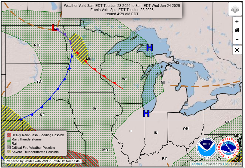
Current models suggest a weak system will bring increased moisture and instability into the area this evening, with precipitable water values expected to rise significantly. This means a greater likelihood of showers and isolated thunderstorms developing late tonight into Wednesday morning. As the system continues to move through, we can expect a new wave of storms Wednesday afternoon.
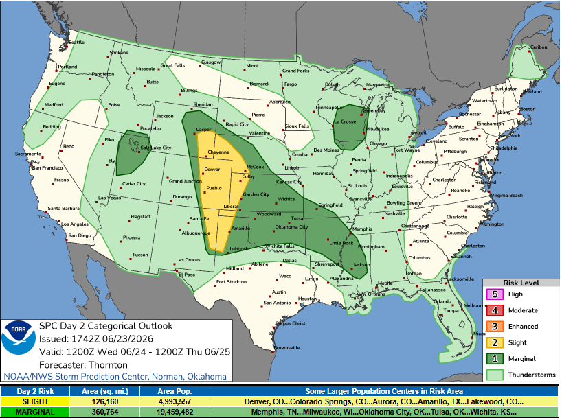
According to the National Weather Service, the main window of opportunity for stronger storms tomorrow currently looks like 4 to 10 PM
. The potential for organized storm development exists, primarily characterized by damaging winds and hail as the main hazards for any severe storms that develop.
Weather Beyond Wednesday
Looking ahead to Thursday, scattered showers may linger, particularly in eastern areas. However, we can expect a drying trend as high pressure moves in. Temperatures will be slightly below normal through Friday but should start warming as we approach the weekend.
Looking Toward Next Week
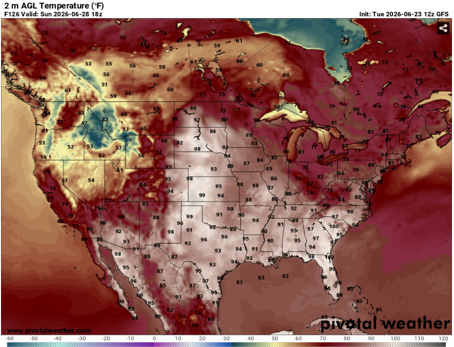
By early next week, expect a strong warming trend, with temperatures possibly nearing Heat Advisory criteria by Monday and Tuesday. While dry weather is anticipated during this period, there’s also a chance for storms to move through, adding some uncertainty to the forecast.
Be sure to stay tuned for updates as conditions evolve. For updated forecasts where you live, check out our Forecasts Page.
Source: NWS MKX Area Forecast Discussion, issued 2026-06-23T17:59:00+00:00.
