

Wildfire smoke will continue to cycle over Northeast Wisconsin today and strong to severe storms are coming Monday.
3 Things To Know:
- A plume of wildfire smoke is impacting air quality and visibility.
- Severe thunderstorms are likely Monday afternoon and evening.
- Expect transitions to drier weather mid-week after the storm system passes.
Air Quality and Visibility Concerns
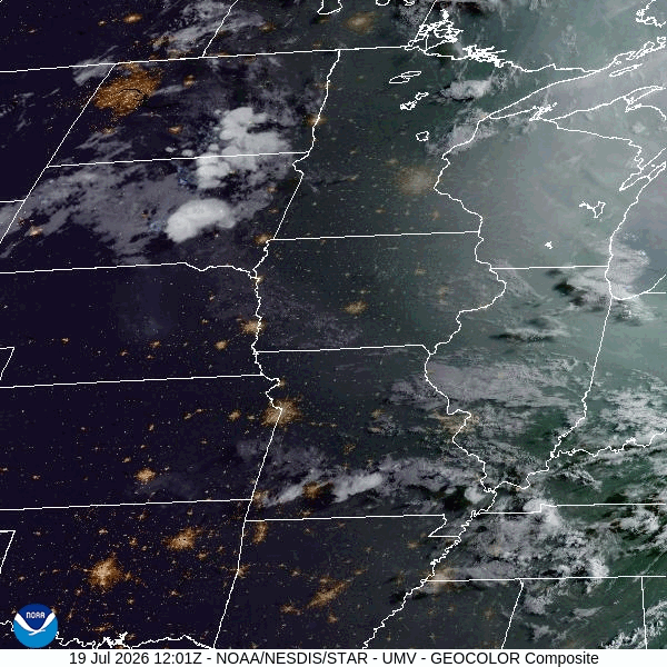
Wildfire smoke will continue to cycle over Northeast Wisconsin today, leading to degraded air quality and reduced visibility at times. Currently, an Air Quality Advisory is in effect statewide through noon Monday. Some areas may experience visibility below three miles.
Thunderstorm Outlook
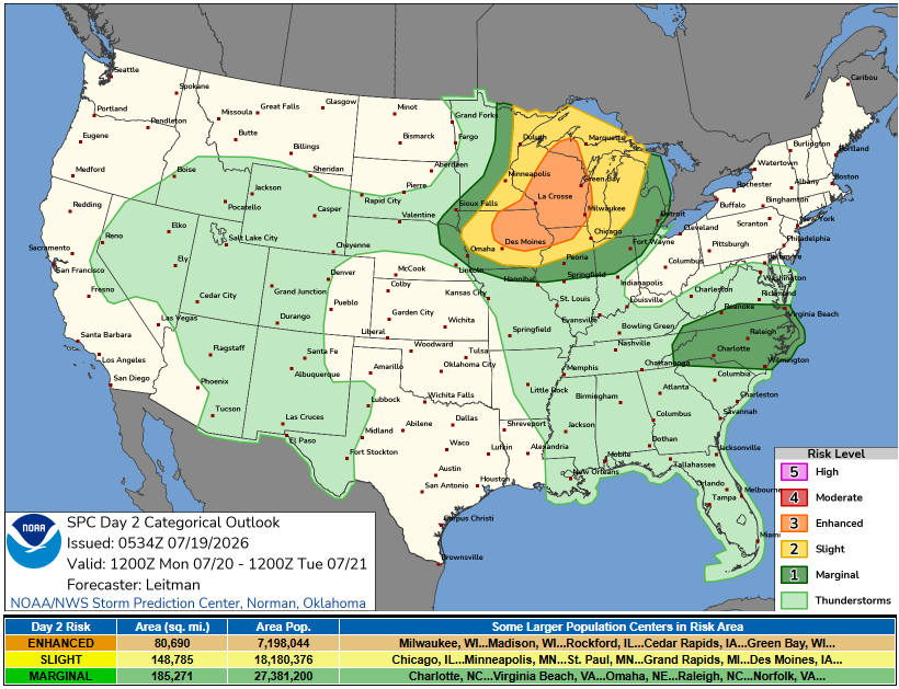
A significant weather event is on the horizon for Monday. The National Weather Service indicates a 60-80% chance of thunderstorms impacting the region from the afternoon into the night. A level 3 out of 5 severe thunderstorm risk is anticipated Monday afternoon and evening. According to the latest forecast discussion:
“Multiple clusters of storms will develop well west and north of the forecast area Sunday night… These storms will likely be on a downward trend… However, can’t entirely rule a marginal risk for severe hail or damaging winds.”
The main concern will be the potential for severe weather, including large hail and damaging winds. As conditions align, we could see discrete supercells transitioning into clusters with damaging winds and possible tornado spin-ups as they move eastward.
Weather Transition Post-Storm
Following the storms, conditions are expected to stabilize and dry out mid-week as high pressure builds over the region. This should bring more pleasant weather with temperatures dropping to near or below average for a brief period.
For updated forecasts where you live check out our Forecasts Page.
Source: NWS GRB Area Forecast Discussion, issued 2026-07-19T16:30:00+00:00.
