
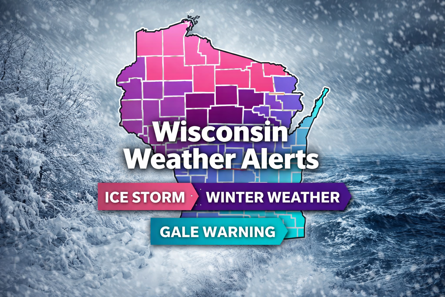
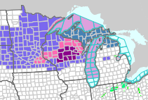
A wide range of alerts are in effect across Wisconsin as this complex storm system moves in, highlighting the multi-hazard nature of this setup. The biggest concern centers on significant icing across central and northern Wisconsin, where Ice Storm Warnings are in place and travel is strongly discouraged. Surrounding areas, including parts of west-central, east-central, and lakeshore communities, are under Winter Weather Advisories for lighter icing and mixed precipitation that can still create hazardous travel. Meanwhile, strong winds over Lake Michigan have triggered Gale Warnings and Small Craft Advisories, signaling dangerous conditions for mariners through Thursday into early Friday.
Current Alerts by Category (as of publised date and time)
Ice Storm Warnings
- Clark and Taylor counties including Medford and Neillsville
- Jackson County including Black River Falls
- Wood, Portage, and Waupaca counties including Wisconsin Rapids, Stevens Point, Marshfield, and Waupaca
- Ice accumulations of 0.25 to 0.50 inch possible with wind gusts up to 35 mph
- Impacts: Likely power outages, tree damage, and nearly impossible travel
Winter Weather Advisories
- West-central Wisconsin including La Crosse, Monroe, Juneau, Adams, Vernon, and Trempealeau counties
- East-central Wisconsin including Appleton, Oshkosh, Neenah, Chilton, and Wautoma
- Lakeshore communities including Green Bay, Manitowoc, Sturgeon Bay, and Kewaunee
- Ice accumulations generally between 0.10 and 0.25 inch with some sleet and light snow
- Impacts: Slippery roads, hazardous travel, and isolated power outages possible
Gale Warning (Lake Michigan)
- Open waters and nearshore zones from Sturgeon Bay to the Illinois border
- Southeast winds 15 to 25 knots with gusts up to 35 knots
- Waves building 6 to 11 feet
- Impacts: Dangerous boating conditions with risk of capsizing or vessel damage
Small Craft Advisories
- Nearshore waters from Sturgeon Bay to Sheboygan and south to Illinois
- Winds 15 to 25 knots with gusts up to 30 knots
- Waves building 5 to 10 feet
- Impacts: Hazardous conditions for smaller vessels, especially inexperienced operators
Hazardous Weather Outlook Highlights
- Significant icing and sleet expected tonight into Thursday across central and northern Wisconsin
- Strong to severe thunderstorms possible Thursday afternoon and evening, especially in the Fox Valley and lakeshore areas
- Additional heavy rain and wintry mix expected late Friday into Saturday
- Ongoing risk for hazardous travel, power outages, and localized flooding
Bottom Line
This is a high-impact, multi-day weather event with overlapping hazards across Wisconsin. From ice storms to severe thunderstorms and dangerous marine conditions, nearly every part of the state will see some level of impact through Thursday and into the weekend.