
3 Things To Know:
- Warming trend continues, with highs reaching the 80s later this week.
- Expect rain late Monday night through Tuesday morning, but minimal impacts are anticipated.
- A brief cool down on Wednesday will give way to warmer temperatures for the weekend.
Weather Overview
The latest forecast for Western Wisconsin calls for rain Monday night and then after a cooler day or two we can expect a warming trend as we head into the week. Expect daytime highs to reach the 80s by Friday and into the weekend.
Rain Chances Late Monday Night
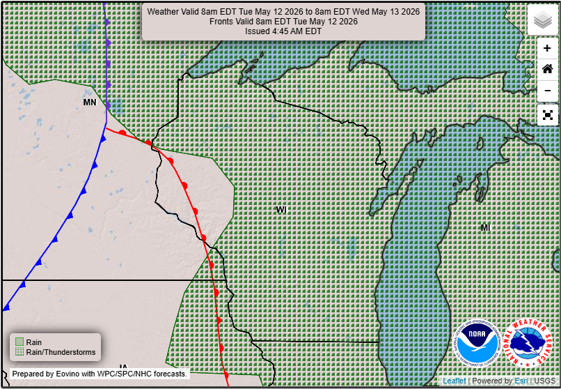
Precipitation is likely late Monday night through Tuesday morning due to an upper-level wave moving across the region. While some showers are anticipated, current estimates suggest rainfall amounts around a quarter-inch, mostly affecting the northern half of the forecast area. The impacts from this rain are expected to be limited.
As stated in the Area Forecast Discussion, “Current diurnal timing limits overall instability” limiting the extent of rainfall potential.
After The Rain Comes A Warm Weekend
For those planning their outdoor activities, the forecast calls for warm temperatures, especially from Thursday through the weekend. Expect highs to reach into the low to mid-80s as we transition from midweek coolness back into a summer-like feel.
Overall, confidence is building that this trend will hold, making late week and weekend plans more promising for warm weather enthusiasts.
Summary
In summary, keep an eye on the skies late Monday night for some rain, but a sustained warm-up follows, making for a pleasant end to the week. For updated forecasts where you live check out our Forecasts Page.
Source: NWS ARX Area Forecast Discussion, issued 2026-05-11T17:43:00+00:00.