

3 Things To Know:
- Near-record heat is expected today and tomorrow, although cloud cover will limit extreme temperatures.
- A Gale Warning is in effect for the Twin Ports tonight due to increasing winds from a cold front.
- Near-critical fire weather conditions are likely through early next week.
Heat Continues
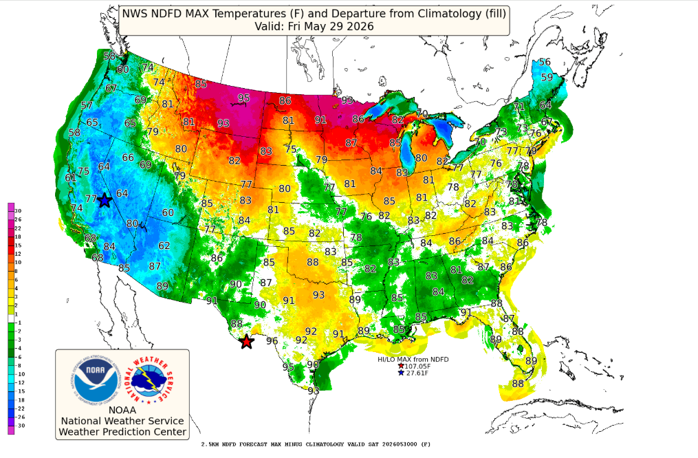
Today, Northwest Wisconsin is experiencing record to near-record heat, despite some high clouds working to limit the temperature rise. With temperatures soaring, it will feel hotter than it actually is. According to the National Weather Service, “We are barely nicking Heat Advisory criteria this afternoon…” However, there isn’t a formal advisory in place because of the cloud cover.
Upcoming Gale Warning
As the day progresses, expect a shift in conditions. A backdoor cold front will pass through the region tonight, leading to significantly increased winds, especially over Lake Superior. The NWS has issued a Gale Warning for the Twin Ports, with winds potentially reaching up to 35 knots and waves building. This warning will be in effect until Saturday afternoon.
Fire Weather Concerns
Looking ahead, dry conditions and low humidity will create near-critical fire weather conditions almost daily. Relative humidity levels are expected to drop below 25 percent, raising concern for uncontrolled fires in the region as we move into the weekend.
What to Expect
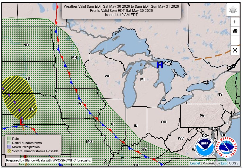
On Saturday, keep an eye out for isolated storms related to the same cold front, especially in inland areas where temperatures could still reach the 80s, while areas near Lake Superior may see a drop to the 60s. Sunday through Monday will remain dry with typical highs in the 70s near the lake and 80s inland. While the immediate forecast looks stable, a longer-term outlook indicates a chance of even hotter conditions starting mid-next week.
For updated forecasts where you live check out our Forecasts Page.
Source: NWS DLH Area Forecast Discussion, issued 2026-05-29T17:27:00+00:00.
