
3 Things To Know:
- Severe storms are possible this afternoon with damaging winds and a potential for tornadoes.
- A Flash Flood Watch is in effect due to heavy rainfall and urban flooding risk.
- Expect a brief respite from storms on Friday with mostly clear skies and highs near 80 degrees.
Severe Storms This Afternoon
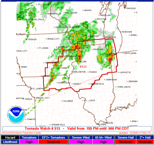
The National Weather Service has issued a Flash Flood Watch for Southeast Wisconsin through this evening. This warning is crucial due to the expected development of severe thunderstorms later today. As areas of low pressure move northeast, there is a conditional risk for severe storms, particularly along and south of the I-94 corridor.
A Tornado Watch has been issued for the following counties:
- GREEN
- LAFAYETTE
- ROCK
- KENOSHA
- RACINE
- WALWORTH
“Damaging winds and tornadoes are the primary concern, with large hail being a secondary threat.” – NWS
This afternoon, counties adjacent to the Wisconsin-Illinois state line seem most at risk for tornado development, depending on how well the atmosphere recovers following morning storms. Heavy rainfall rates could reach between 1 to 2 inches per hour, which may lead to flash flooding, especially in urban and slow-drainage areas.
Friday Weather Outlook
After today’s storms, Friday is expected to bring quieter conditions with weak high pressure settling in. You can look forward to mostly clear skies and temperatures reaching the lower 80s.
Future Forecasts
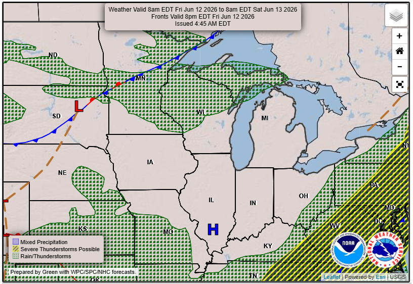
Looking ahead, we anticipate another round of showers and thunderstorms on Saturday. Conditions may yield marginally severe weather again, with isolated thunderstorms developing during the afternoon.
For updated forecasts where you live check out our Forecasts Page.
Source: NWS MKX Area Forecast Discussion, issued 2026-06-11T18:51:00+00:00.