
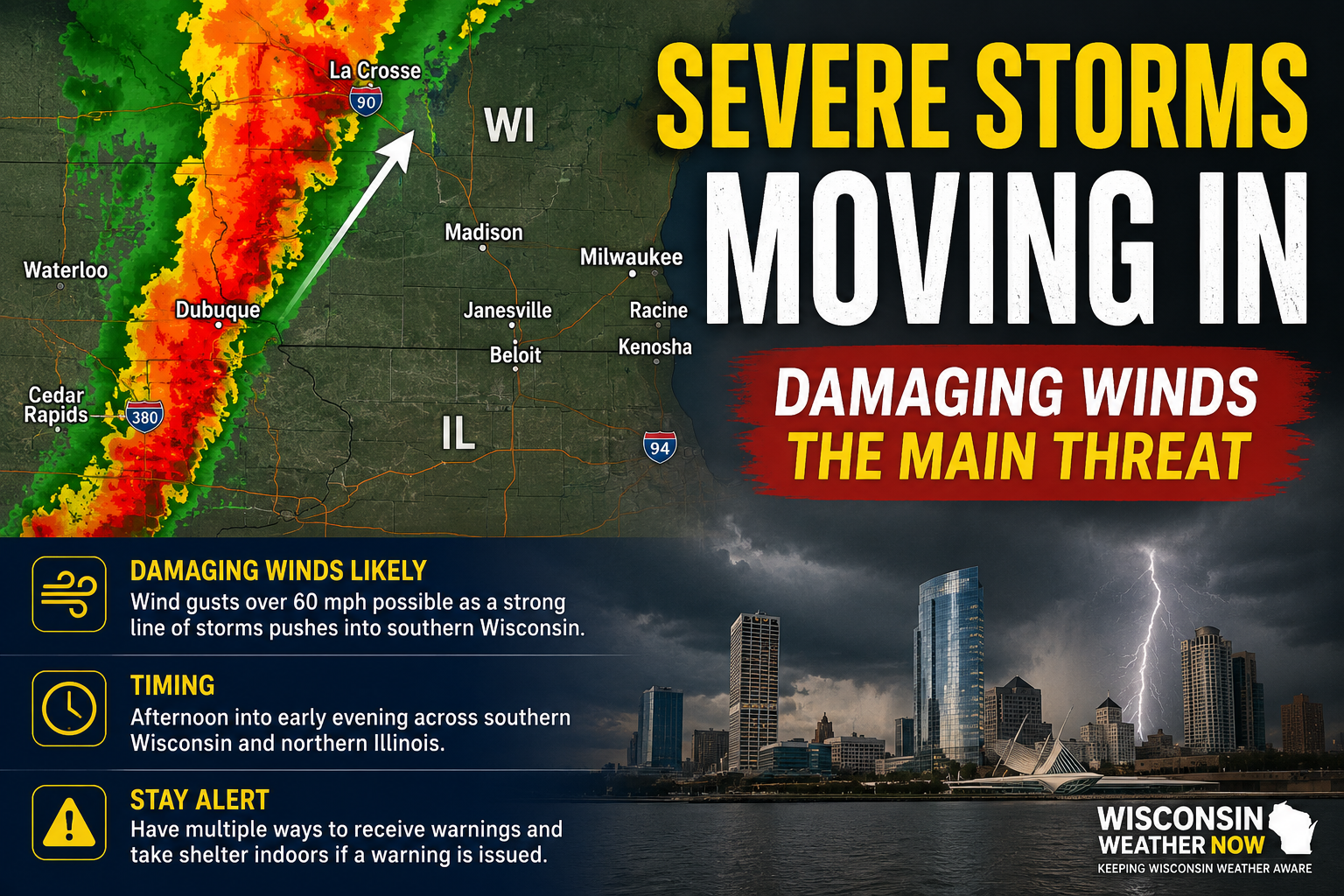
MILWAUKEE, Wis. — A rapidly organizing line of severe thunderstorms is moving out of eastern Iowa and into southern Wisconsin this afternoon, bringing the potential for widespread damaging winds as it pushes northeast across the state.
3 Things To Know:
- A line of severe thunderstorms is moving out of eastern Iowa and into southern Wisconsin this afternoon, with damaging winds of 60-80 mph posing the greatest threat.
- Storms have already produced a 74 mph wind gust near Dubuque, Iowa, and are moving into an environment favorable for maintaining severe intensity across southern Wisconsin.
- The highest risk window is through this evening. Have multiple ways to receive warnings and remember that severe thunderstorm warnings can signal life-threatening winds capable of producing damage similar to a tornado.
The National Weather Service’s Storm Prediction Center issued a Mesoscale Discussion Wednesday afternoon highlighting an increasing threat of severe weather across southern Wisconsin and northern Illinois. The discussion notes that a well-organized line of storms has already produced a wind gust of 74 mph near Dubuque, Iowa, and is expected to maintain its strength as it enters Wisconsin.
What We’re Watching
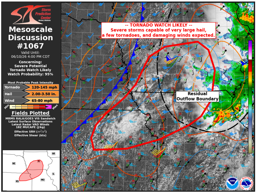
Forecasters say the environment across southern Wisconsin is becoming increasingly favorable for severe thunderstorms.
Key ingredients include:
- Very unstable air with more than 2,500 J/kg of CAPE along the Wisconsin-Illinois border
- Strong wind shear around 40 mph
- A strengthening line of thunderstorms capable of producing widespread damaging winds
- Potential for wind gusts exceeding 60 mph
The greatest threat appears to be straight-line winds, though isolated hail and brief spin-up circulations cannot be ruled out.
Timing
The line of storms is expected to continue advancing northeast through the afternoon and early evening hours.
Areas from Madison to Milwaukee, Kenosha, Racine, Janesville, Beloit and surrounding communities should closely monitor conditions as storms approach.
Additional rounds of thunderstorms remain possible tonight and Thursday.
Final Thoughts
Today’s setup is a good reminder that tornadoes are not the only severe weather threat capable of causing significant damage.
In fact, widespread straight-line wind events often impact far larger areas than tornadoes and can produce damage that looks very similar. With reports already approaching 75 mph in eastern Iowa, residents across southern Wisconsin should take severe thunderstorm warnings seriously this afternoon.
If a warning is issued for your location, move indoors immediately and stay away from windows until the storm passes.
Stay Weather Aware
Wisconsin Weather Now will continue providing updates throughout the afternoon as storms move into the state on our live stream.
Have multiple ways to receive warnings, especially if you’ll be outdoors, traveling or attending afternoon activities.