

3 Things To Know:
- Scattered showers and thunderstorms possible this afternoon, mainly north of a line from Lone Rock to Burlington.
- Hot and humid weather likely next week, with potential for Heat Advisory conditions.
- Chances for storms return Saturday night into Sunday and again Tuesday through Thursday.
Eveing Showers and Storms
This evening will bring a chance for widely scattered showers and thunderstorms, particularly north of the line connecting Lone Rock to Janesville. While severe weather is not anticipated, brief heavy downpours and lightning may occur with any storms that develop. Expect these weather events to wind down by early evening as instability decreases.
Cooler Evening Ahead
This evening will see the continued presence of scattered cloud cover. Winds will remain light, and overnight temperatures are expected to drop to a few degrees below normal.
Weekend Heat on the Horizon
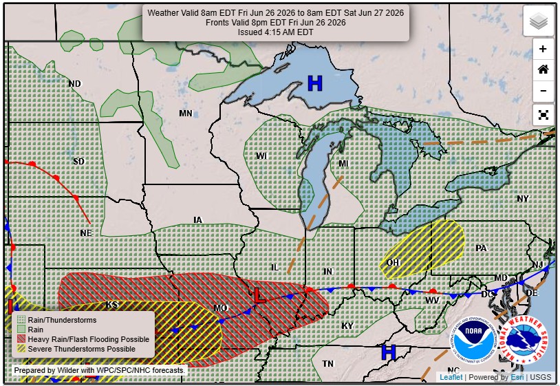
Moving into Friday and Saturday, we can expect dry conditions as upper-level ridging begins to develop across the region. Friday’s temperatures will remain below normal due to increasing clouds, but as the upper ridge strengthens on Saturday, temperatures should warm to around normal levels.
More Heat Next Week
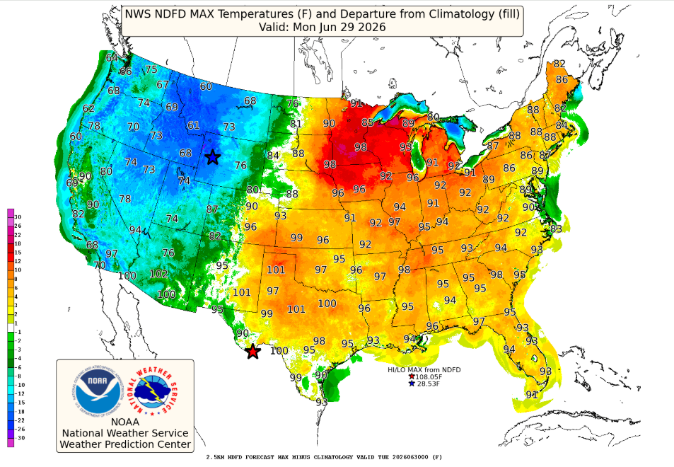
As we look ahead to next week, the forecast calls for rising temperatures and increasing humidity. Southern Wisconsin may experience Heat Advisory criteria from Monday through Thursday, especially if dry weather persists during the day. Be prepared for a few rounds of showers and storms returning Tuesday through Thursday.
As noted in the latest forecast discussion:
“Upper level ridging will continue to strengthen across the Midwest and Northeast United States early next week.”
For those with outdoor plans, it’s vital to stay updated on weather conditions as they evolve.
For updated forecasts where you live check out our Forecasts Page.
Source: NWS MKX Area Forecast Discussion, issued 2026-06-25T17:37:00+00:00.
