

3 Things To Know:
- Extreme Heat Warning in effect from noon today through Tuesday evening.
- Isolated showers and storms are possible starting tonight with chances increasing later in the week.
- High swim risk conditions along Lake Michigan beaches; exercise caution if swimming.
Overview
Southeast Wisconsin is bracing for extreme heat as high humidity levels combine with rising temperatures. An Extreme Heat Warning goes into effect at noon today and will remain in place until Tuesday evening. This prolonged heatwave will likely require additional heat-related headlines later in the week.
Heat Warning Details
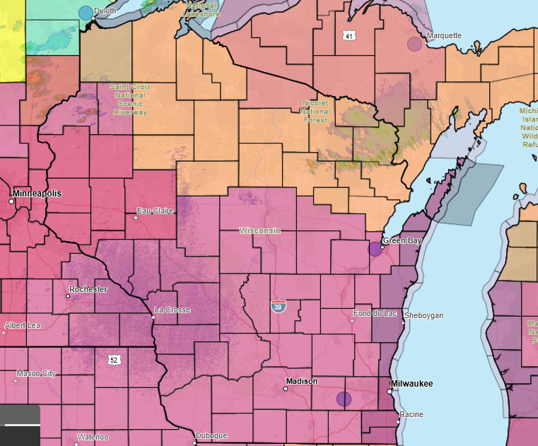
Expect temperatures in the lower to middle 90s with dewpoints in the mid-70s. These conditions will produce heat index values reaching between 100 and 110 degrees Fahrenheit, prompting the Extreme Heat Warning. The NWS advises:
“Stay hydrated and avoid strenuous outdoor activities during peak heat hours.”
As a precaution, those working or spending time outside should take breaks and limit time in the direct sun.
Storm Chances
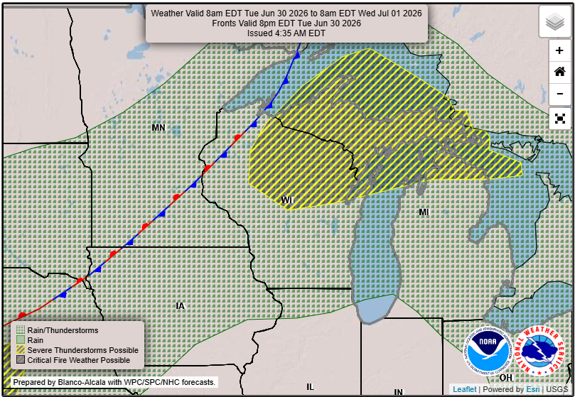
Starting tonight, isolated showers and storms may develop due to a low-level jet bringing moisture from the south. While most of southeastern Wisconsin will remain on the edge of severe weather, expect a slight chance for rain, particularly in central Wisconsin. The likelihood for daily storm chances increases from Tuesday night through the end of the week as the weather pattern remains warm and humid.
Beach Conditions
High swim risk conditions are in effect for beaches in Ozaukee and Sheboygan Counties, with moderate swim risks in Milwaukee and Racine Counties. Swimmers should stay vigilant as the surf may pose a danger, especially in designated high swim risk areas. Avoid piers and breakwalls under these conditions.
More Heat Ahead
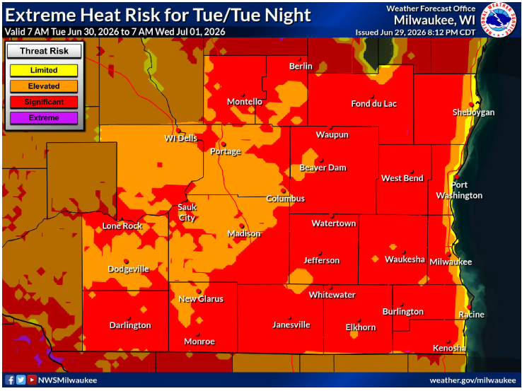
The heatwave is expected to persist through much of the week. As shortwave troughs move in from the western U.S., we can expect an ongoing humid air mass, boosting storm chances late in the week.
Stay informed and check local updates regularly as the weather continues to develop.
For updated forecasts where you live check out our Forecasts Page.
Source: NWS MKX Area Forecast Discussion, issued 2026-06-29T11:57:00+00:00.
