

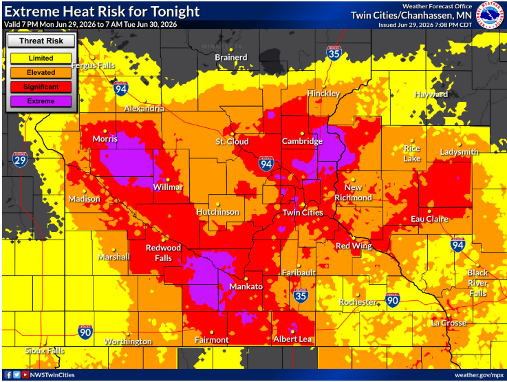
3 Things To Know:
- An Extreme Heat Warning is active for central Wisconsin and the Fox Valley, while a Heat Advisory covers the rest of the region.
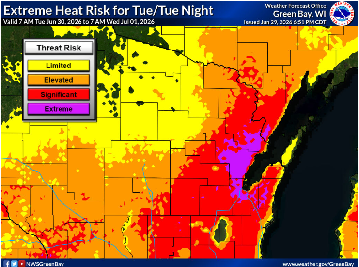
- Dangerous heat with high humidity will continue into the middle of the week, increasing heat-related impacts.
- Chances for thunderstorms exist, with potential for severe weather bringing damaging winds and heavy rain.
Heat Alerts in Place
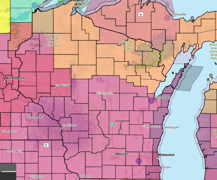
As of this afternoon, an **Extreme Heat Warning** is in effect for central Wisconsin and the Fox Valley, running through 7 PM CDT Tuesday. For the remainder of northern and northeastern Wisconsin, a **Heat Advisory** is also active during this time. Temperatures are expected to climb into the 90s, with heat indices reaching potentially dangerous levels above 100 degrees.
According to the National Weather Service, the most extreme heat is likely to impact areas from central Wisconsin to the Fox Valley tomorrow afternoon. **”Probabilistic guidance remains in good agreement on heat indices over 104 today and again on Tuesday,”** indicating significant heat risk for residents without adequate cooling measures.
Thunderstorm Potential
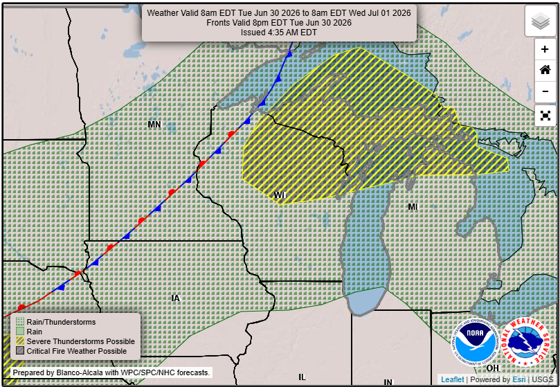
In addition to the heat, this week brings chances for thunderstorms. Ample moisture and heat will create instability for storm development, particularly by tomorrow afternoon. However, a warm layer of air above us may limit the development of the most severe storms. As the heat dome shifts east, we must be vigilant for storms that could produce damaging winds and heavy rainfall.
While initial storm activity may be subdued, meteorologists are monitoring for possible stronger storms as we move into midweek. The primary hazards for tomorrow’s storms include damaging winds and large hail.
What to Expect This Week
For those along Lake Michigan, expect lower heat-related impacts due to the cooling influence of the water. However, the humidity will still make the temperatures feel oppressive. Overnight temperatures are unlikely to dip below 75 degrees, providing little comfort.
Looking forward to the 4th of July weekend, the heat is expected to persist into Friday, with chances for additional storms before cooler conditions set in over the weekend. Strong to severe storms are also possible as instability builds during peak heating periods.
Make sure you stay hydrated and check on vulnerable individuals in your community as we navigate this heat wave.
For updated forecasts where you live check out our Forecasts Page.
Source: NWS GRB Area Forecast Discussion, issued 2026-06-29T18:15:00+00:00.
