

3 Things To Know:
- Showers and storms likely tonight into Tuesday, with a low risk of damaging winds.
- Periodic rain chances from Thursday night through Saturday.
- Temperatures will remain near normal, with highs mostly in the 70s and low 80s.
This week, Western Wisconsin can expect mild weather conditions with temperatures reaching the upper 70s to low 80s. A few rounds of showers and thunderstorms are on the radar tonight and into Tuesday, primarily affecting the northwestern part of the region.
Tonight into Tuesday: Showers and Storms
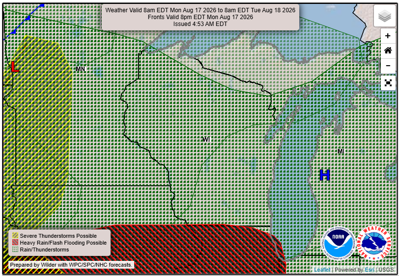
Initially, showers and thunderstorms will develop in the Dakotas and northern Minnesota before moving southeast towards us. While the potential exists for these storms to reach our area, they may weaken significantly before arrival. According to the National Weather Service, the more likely scenario is that showers and storms remain below severe levels during the day on Tuesday.
If storms do move through, the main concern will be damaging wind gusts. Although there is a small chance for large hail, confidence in this is low. Most storm activity should clear by mid-afternoon on Tuesday, but some isolated showers or storms may linger into the evening.
Midweek Forecast: Quiet Weather Before More Rain
Wednesday is expected to be relatively calm as an upper-level trough influences our weather, providing a brief respite from the rain. However, as the week progresses, particularly Thursday night through Saturday, more showers and storms could move into the area due to new atmospheric developments.
Weekend Outlook: Mild Conditions Ahead
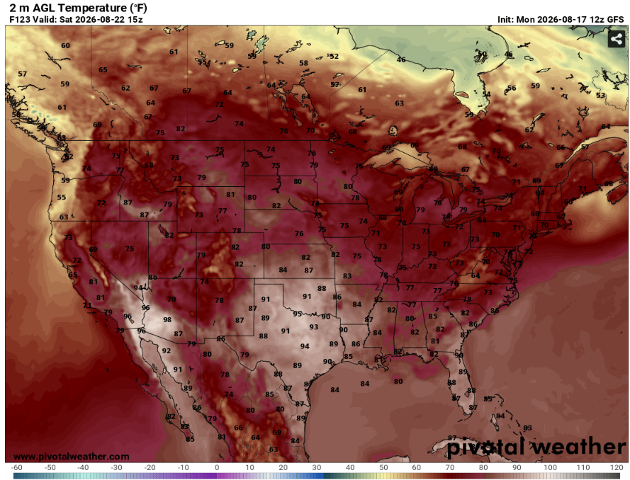
As we head into Saturday night and early next week, the forecast indicates a return to dry, mild weather. While there may be an uptick in storm chances once again, temperatures are expected to remain comfortable, predominantly in the lower 80s to upper 70s.
For updated forecasts where you live check out our Forecasts Page.
Source: NWS ARX Area Forecast Discussion, issued 2026-08-17T18:09:00+00:00.
