

A chilly start to March in Wisconsin gives way to a steady warm-up, mixed precipitation early, and increasing rain chances by Friday.
3 Things to Know
- Light lake effect flurries early, then dry and chilly to start the week
- Mixed precipitation possible Monday night into Tuesday, mainly south
- Well above normal temperatures with multiple rain chances late week
March is coming in like a lamb, but with a few Wisconsin twists like rain.
After a cold start to the month, all three major National Weather Service offices covering the state, National Milwaukee/Sullivan, Green Bay and La Crosse — are pointing toward a gradual warm-up with periodic precipitation chances through the week.
Here’s how it breaks down by region.
Southeast Wisconsin: Milwaukee/Sullivan Forecast Area
Monday: Turning the Corner
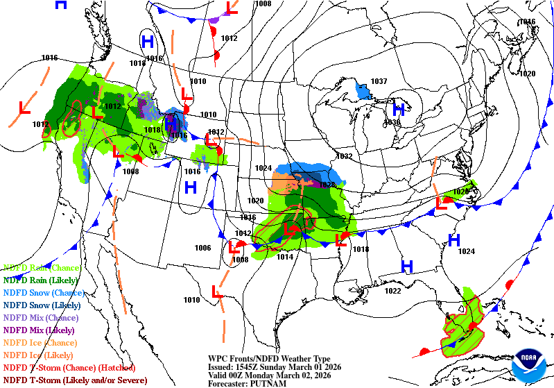
High pressure slides east, winds turn south to southeast, and temperatures climb above normal. Expect increasing clouds but dry conditions during the day.
Monday Night Into Tuesday: Light Rain Chances
A warm front lifting north brings 50 to 70 percent chances of light rain, especially across southern Wisconsin. Rainfall looks light for now, but model differences remain on how organized the system becomes.
Late Week: Milder, Wetter Pattern
By Thursday and Friday, confidence increases in a stronger system developing to our west. That would bring:
- South winds
- Periods of rain
- Well above normal temperatures
Rain chances climb into the 50 to 60 percent range Friday into Friday night, with smaller chances lingering into Saturday.
Northeast Wisconsin: Green Bay Forecast Area

Cold Start, Then Steady Warm-Up
Highs Sunday range from around 20 degrees in north-central Wisconsin to the upper 20s and near 30 elsewhere. Wind chills dip into the single digits early.
From there, a slow but steady warming trend begins:
- 40s by midweek
- 40s to even lower 50s by Friday, especially south of Highway 29
There’s a 50 to 85 percent chance of hitting 50 degrees by Friday in parts of east-central Wisconsin.
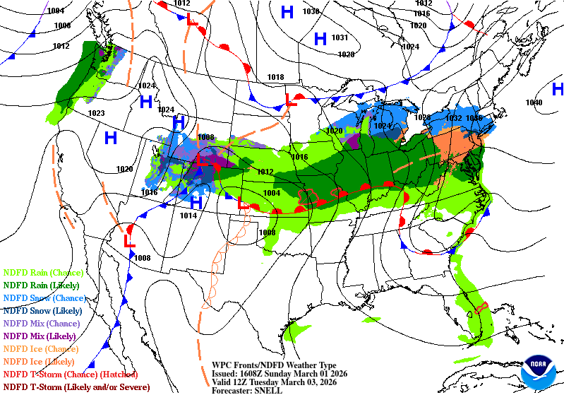
Monday Night Into Tuesday: Mixed Precipitation Possible
Precipitation probabilities range from 20 to 50 percent. Thermal profiles hover near freezing, so a rain and snow mix is possible, especially south of Highway 29.
At this point:
- Snow amounts over 1 inch remain under 25 percent
- Overall precipitation looks light
Still, forecasters are watching for any northward shift that could increase impacts.
Mid to Late Week: Rain And Monitoring Rivers
Rain chances continue midweek at lower coverage, then increase late week (40 to 60 percent).
With rising dewpoints and melting snow:
- Fog chances increase on calm nights
- Ice jam and minor flooding concerns grow on rivers
- Gusty south winds Monday may push ice floes around Green Bay
The overall flood threat remains low unless heavier rain materializes.
Western And Southwest Wisconsin: La Crosse Forecast Area
Temperatures: From 20s To 50s
Sunday stays colder than normal, with highs in the 20s to low 30s.
By Tuesday:
- Highs climb into the 40s
- Continued warming trend into the 50s by late week
Southwest flow becomes more influential as the week progresses.
Monday Night Into Midweek: Lower Confidence
Confidence in widespread wintry precipitation has decreased. A weaker system means lower impacts for now, with about a 20 percent chance of wintry mix Monday night into Tuesday morning.
Persistent precipitation chances linger midweek, primarily across southern portions of the forecast area.
Late Week: Heavy Rain And Thunder Potential Nearby
By late week, stronger southwest flow could bring:
- Heavy rain potential
- Isolated thunder
The highest risk currently appears along and south of the Wisconsin border, but any northward shift would need close monitoring.
The Big Picture For Wisconsin
- Below normal today
- Gradual warm-up beginning Monday
- Mixed precipitation possible early week
- Multiple rain chances late week
- Well above normal temperatures by Friday
In short, we’re transitioning out of the deep freeze and into a more spring-like pattern. That means fluctuating precipitation types early, then a better signal for rain and melting snow by the end of the week.
March may not roar in, but it’s definitely changing the tone. Watch our Forecast Page and Maps Page for updates.
