
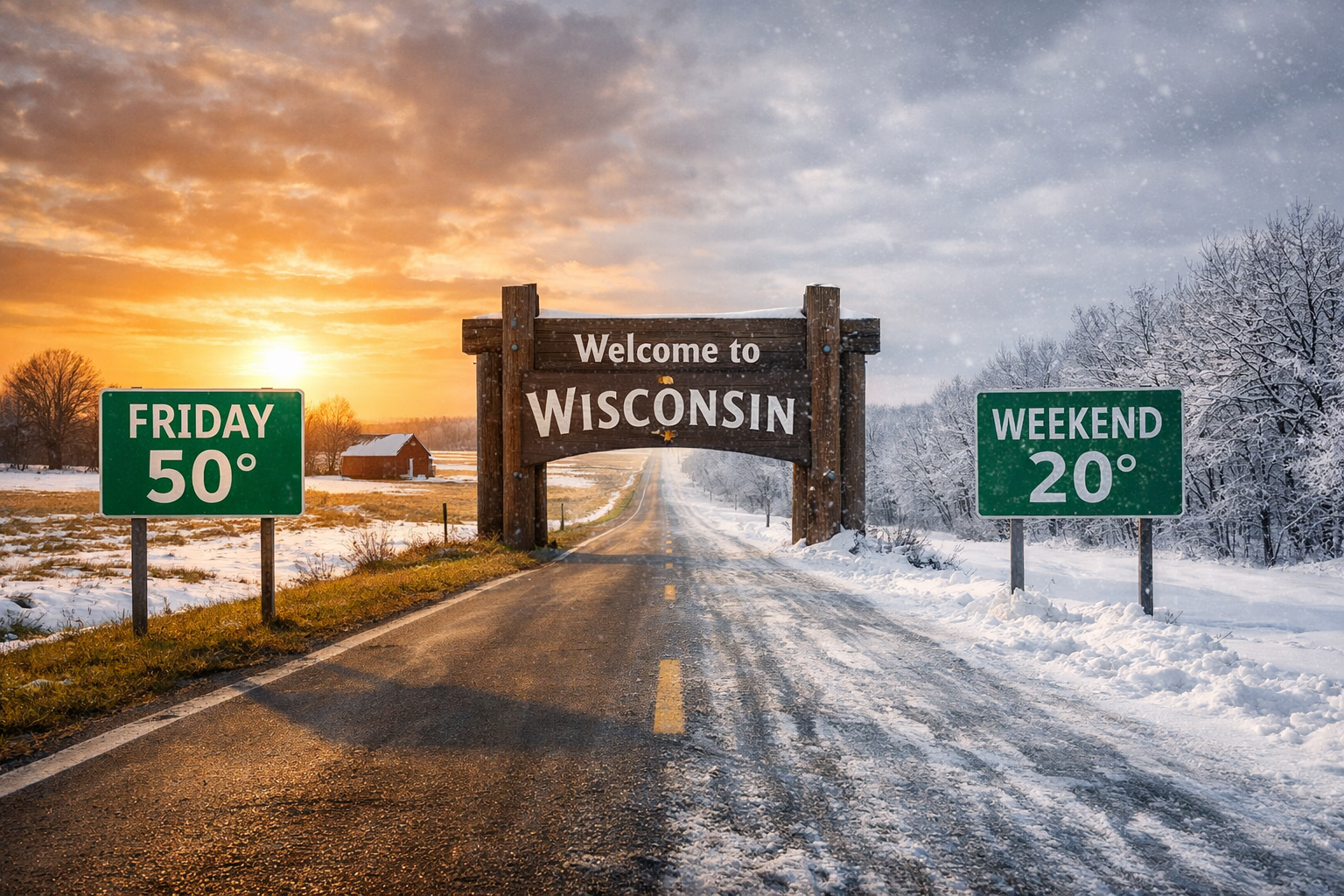
Wisconsin warms into the 40s and 50s Friday before temperatures fall back into the 20s this weekend. Here is what to expect statewide.
3 Things to Know
- Friday brings a high confidence warm-up with 40s statewide and some 50s possible in southwest Wisconsin
- Snow-covered areas may not warm as much as locations with bare ground
- Highs fall back into the 20s for Saturday and Sunday as cooler air returns
Wisconsin is set for a brief taste of spring Friday before winter quickly reasserts itself for the weekend.
Forecast discussions from the National Weather Service Green Bay and National Weather Service La Crosse highlight a strong warm surge Friday, followed by a fast return to colder air Saturday and Sunday.
For one day, much of the state will feel more like early April than late February.
“NBM probabilities remain very consistent of at least 80% chance of seeing highs across all areas in the 40s.”
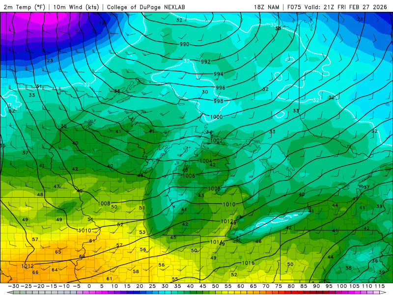
That level of confidence is notable for this time of year. In southwest Wisconsin, forecasters say highs could climb into the upper 40s and even low 50s in spots.
La Crosse forecasters note that 850 mb temperatures between 2 and 6 degrees Celsius are supporting that warmer surface forecast. However, they also caution that existing snowpack could hold some communities back.

“Due to the heavier snowpack, temperatures will be on the cooler side so there is some uncertainty on how warm areas with snow cover actually get.”
In other words, bare ground locations have the best shot at pushing toward 50 degrees. Areas with deeper snow cover may struggle to fully realize the warm potential.
Why the Warm-Up Is Short-Lived
The reason for the quick shift is the broader weather pattern. Wisconsin briefly enters the warm sector Friday with southwesterly flow in the lower levels. That allows warmer air to surge north across the region.
But the pattern does not lock in.
Northwest flow aloft remains in place across the Upper Midwest, and cooler air quickly follows behind the departing system. By Saturday and Sunday, highs are expected to fall back toward the 20s across much of the state.
Green Bay forecasters put it plainly in their discussion, noting that the warmth will be “relatively short-lived” before cooler air returns for the weekend.
That sets up a classic late February swing for Wisconsin: one day that feels like spring, followed by a reminder that winter is not finished yet.
What It Means for the Weekend
By Saturday, temperatures retreat closer to seasonal levels. Sunday looks similar, with highs largely confined to the 20s.
The temperature drop may feel dramatic compared to Friday’s mild air, especially in areas that push into the upper 40s or low 50s.
For those planning outdoor activities, Friday will be the pick day of the stretch. The weekend will bring a more typical late winter feel, with colder afternoons and the potential for slick spots if any daytime melting refreezes overnight.