
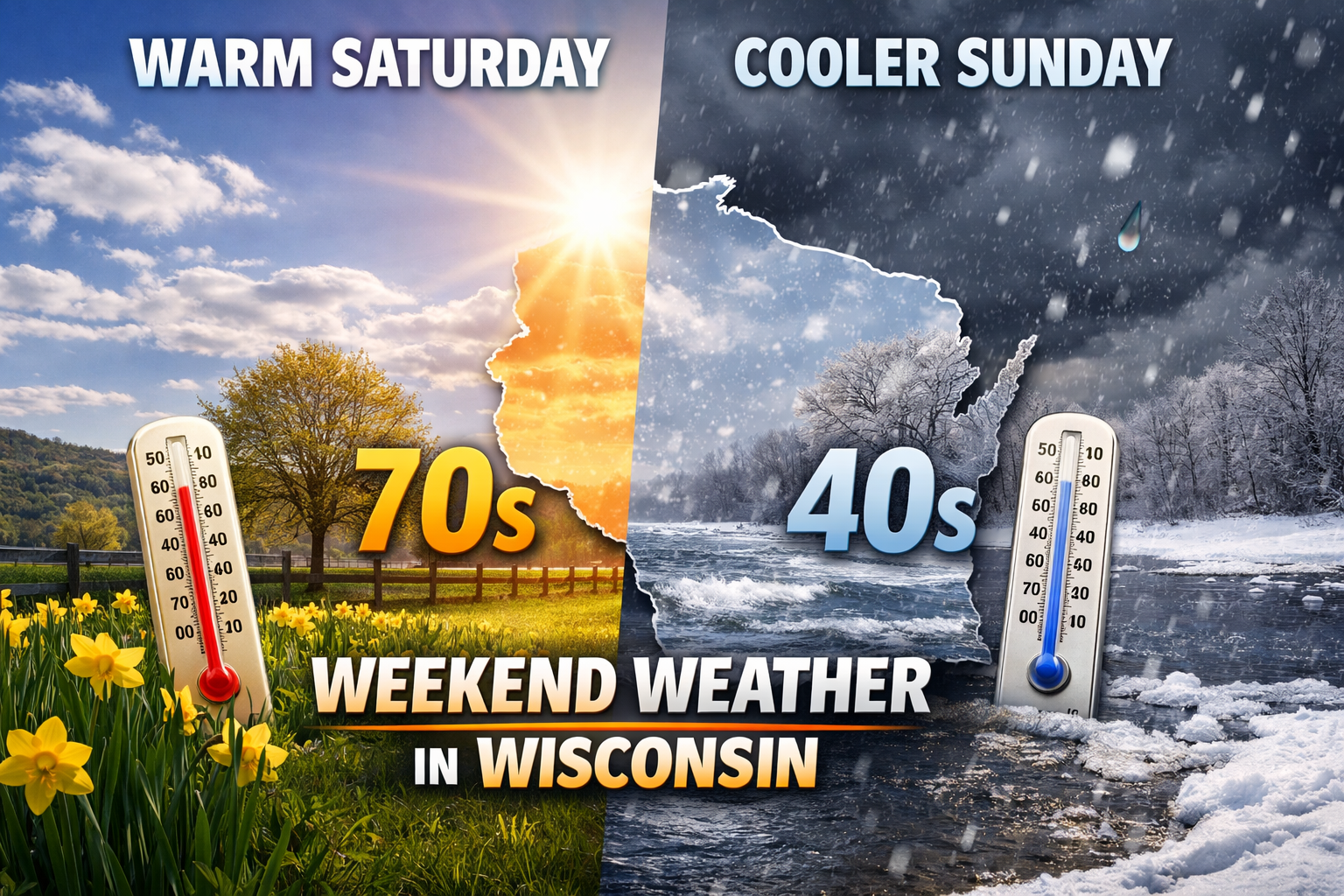
Warm spring surge peaks Saturday before cooler, unsettled Sunday across Wisconsin
A spring warmup pushes temps into the 60s and 70s Saturday before cooler air and spotty rain or snow return Sunday across Wisconsin.
3 THINGS TO KNOW
- Spring surge brings the warmest day of the year so far on Saturday with 60s and 70s
- Light rain or a rain and snow mix possible Saturday night into Sunday
- Cooler air returns Sunday with breezy conditions
THE SETUP: SPRING ARRIVES BRIEFLY

A true taste of spring is on the way for the weekend with sunshine and a steady warming trend. Temperatures will climb well above normal by Saturday.
That warmth will not last long. A clipper system moving through late Saturday into Sunday will bring a chance for light precipitation along with a noticeable cooldown.
SOUTHEAST WISCONSIN (MILWAUKEE, MADISON, LAKESHORE)
Saturday will be the standout day.
Temperatures climb into the upper 50s to low 60s with warmer readings inland. Areas southwest of Madison could approach the low 70s. Near Lake Michigan, cooler air keeps highs in the 50s due to an onshore wind.
A weak system arrives Saturday night into Sunday bringing low rain chances around 15 to 25 percent. Any precipitation looks light and brief.
Sunday turns cooler with highs closer to 50 inland and cooler along the lakeshore. A north to northeast breeze will add to the chill.
CENTRAL AND EAST-CENTRAL WISCONSIN (FOX VALLEY, STEVENS POINT, OSHKOSH)
This region will be near the center of the changing pattern.
Saturday brings highs in the 50s to near 60. Some remaining snowpack could limit how warm temperatures get.
Precipitation chances increase Saturday night into Sunday with a 30 to 50 percent chance, especially north of Highway 10. Expect mainly rain at first, with a rain and snow mix possible as colder air moves in Sunday.
Snowmelt will also be a factor. Rising river levels are expected with some locations approaching bankfull or minor flood stage.
NORTH-CENTRAL AND NORTHERN WISCONSIN
Conditions become more unsettled here late in the weekend.
After highs in the 40s to 50s Friday and Saturday, a system arrives Saturday night with a 30 to 50 percent chance of precipitation. A rain and snow mix is most likely, especially overnight into early Sunday.
Accumulation looks limited, but some minor impacts are possible.
Fog may also develop at times due to melting snow and increased moisture.
WESTERN AND SOUTHWEST WISCONSIN (LA CROSSE REGION)
This area will see the warmest temperatures.
Saturday highs reach the mid 60s to mid 70s, especially west of the Mississippi River. If snow melts efficiently, some areas could end up even warmer than forecast.
Precipitation chances remain low at 15 to 30 percent Saturday night into Sunday, and much of the weekend stays dry.
Sunday brings cooler conditions with highs returning to the 40s and 50s.
THE BOTTOM LINE
Saturday brings a strong taste of spring with widespread warmth and some areas near 70 degrees.
A system moves through Saturday night into Sunday with light precipitation chances.
Sunday turns cooler and breezier with temperatures falling back to more typical March levels.
The overall pattern stays fairly quiet into next week with temperatures near to slightly above normal.
Check our Forecast Page for updates in your area.