
3 Things to Know: June 15, 2022 Tornado Outbreak
- Ten tornadoes touched down across northeast Wisconsin. National Weather Service surveys confirmed 10 tornadoes from the outbreak, including nine EF-1 tornadoes and one EF-2.
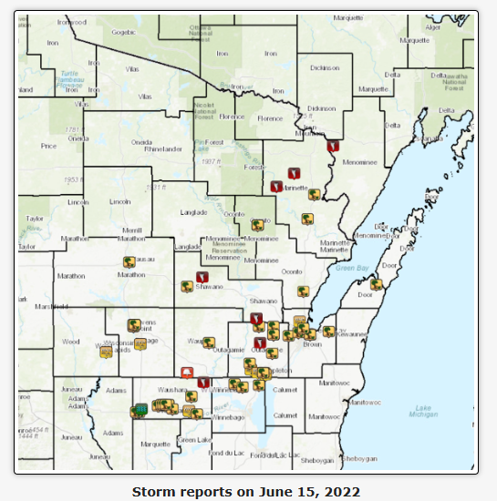
- Damaging winds caused widespread impacts. Fast-moving thunderstorms produced numerous reports of downed trees and power lines from Crivitz to Neenah, with storm motions reaching 40 to 75 mph.
- More than 60,000 customers lost power. The combination of tornadoes and severe straight-line winds knocked out electricity across central and northeast Wisconsin, making it one of the region’s most impactful severe weather events in recent years.
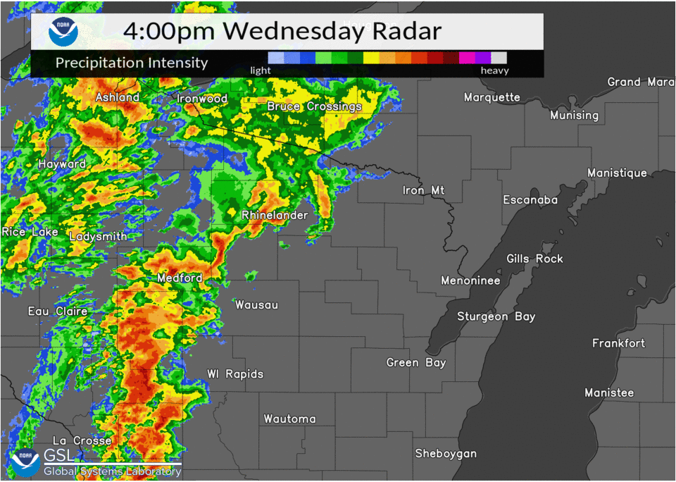
GREEN BAY, Wis. — June 15, 2022, remains one of the most active severe weather days in recent northeast Wisconsin history. A powerful cold front sweeping across the state sparked widespread severe thunderstorms, damaging winds, and an outbreak of 10 tornadoes across the region.
SOURCE: NWS Green Bay
Thunderstorms first developed during the early afternoon over southeast Minnesota and northeast Iowa before rapidly intensifying as they moved into southwest Wisconsin. By mid-afternoon, the storms had surged into north-central Wisconsin, racing northeast at an astonishing 40 to 75 mph.
SOURCE: NWS Green Bay
As the storms intensified, reports of wind damage quickly piled up across Langlade, Marathon, Portage and Waushara counties. The fast-moving storms eventually evolved into a series of broken line segments that continued producing damaging winds as they crossed northeast Wisconsin.
From Crivitz to Neenah, numerous reports of downed trees and power lines were received as the storms swept through the region.
More Than 60,000 Customers Lost Power
The severe weather left a significant mark on Wisconsin’s electrical infrastructure. More than 60,000 utility customers across central and northeast Wisconsin lost power as strong winds toppled trees and damaged power lines.
Many communities spent days cleaning up debris and restoring service following the storms.
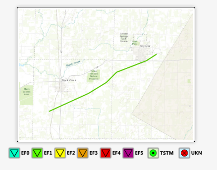
A Rare 10-Tornado Day
SOURCE: NWS Green Bay
Following the event, meteorologists from the National Weather Service office in Green Bay conducted extensive storm damage surveys across east-central and northeast Wisconsin.
Their findings revealed that a total of 10 tornadoes touched down during the outbreak:
- Nine tornadoes were rated EF-1.
- One tornado was rated EF-2.
While Wisconsin averages about 23 tornadoes annually, having 10 tornadoes occur during a single severe weather event is relatively uncommon and highlights just how favorable the atmospheric setup was that day.
What Made the Environment So Dangerous?
A 4 p.m. surface analysis from the Weather Prediction Center showed a wave of low pressure moving northeast along a cold front across central Wisconsin.
At the same time, a warm front stretched from the Upper Peninsula into northern Lake Michigan, placing much of northeast Wisconsin squarely within the warm sector of the storm system.
This setup provided several ingredients needed for severe weather:
- Warm, humid air ahead of the front
- Strong wind shear through the atmosphere
- Enhanced lift along the cold front and near the surface low
- Rapidly developing thunderstorm updrafts
Together, these factors created an environment capable of producing both damaging straight-line winds and multiple tornadoes.
The Bottom Line
June 15, 2022, serves as a reminder that Wisconsin’s severe weather season can produce significant outbreaks, even outside of the traditional “Tornado Alley” region. The combination of 10 tornadoes, widespread wind damage, and tens of thousands of power outages made this one of the most impactful severe weather events to strike northeast Wisconsin in recent years.
As severe weather season continues, it’s a good reminder to have multiple ways to receive warnings and a plan in place when storms threaten. You can track storms any time with our Live Stream.
Source: National Weather Service Green Bay storm surveys and event summaries.