

3 Things To Know:
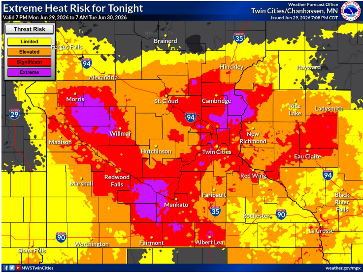
- Dangerous heat persists through at least Wednesday with heat indices reaching the upper 90s.
- Storm chances develop after midnight tonight and again Tuesday afternoon, primarily north of I-94.
- Heat impacts will linger into the latter part of the week, though slightly cooler temperatures are expected.
Heat Advisory and Excessive Heat Warning
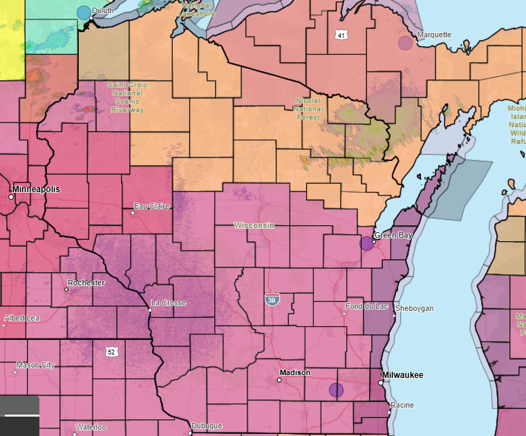
Western Wisconsin is currently under an Excessive Heat Warning through Tuesday evening, with a Heat Advisory in place for Taylor County. Expect high temperatures in the low to mid 90s coupled with dewpoints in the mid to upper 70s, pushing heat index values to dangerous levels.
Storm Potential
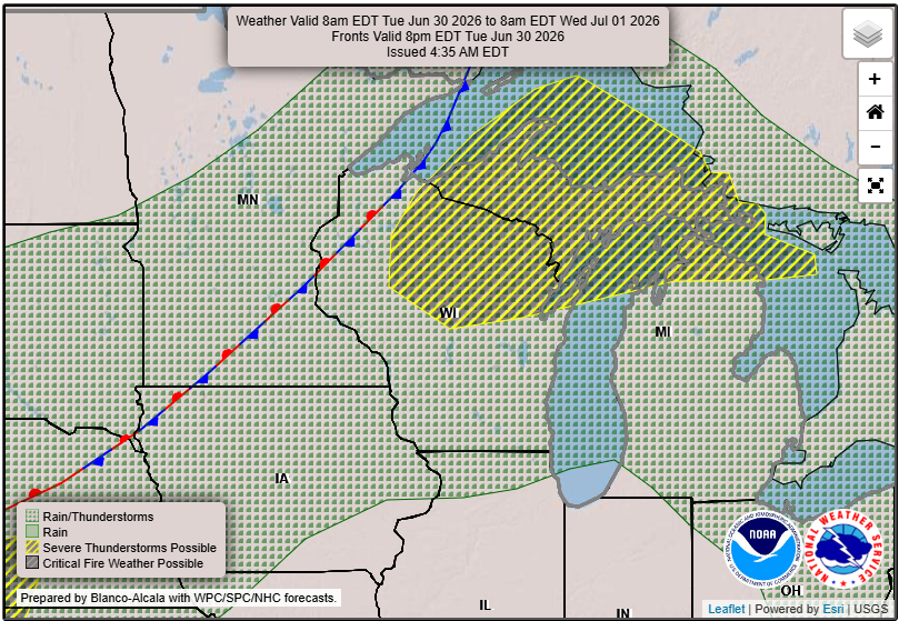
There is a low probability of storms developing in the region tonight and again on Tuesday afternoon. While the strongest storm activity is expected to remain to the northwest, if storms do develop locally, the primary concern will be damaging winds. As noted in the latest Area Forecast Discussion, there is some uncertainty regarding storm initiation due to strong capping in the atmosphere. Local residents should remain vigilant, especially if storms draw closer.
“The expected heat and humidity Tuesday will continue to support the volatile atmosphere in place.”
Mid-Week Outlook
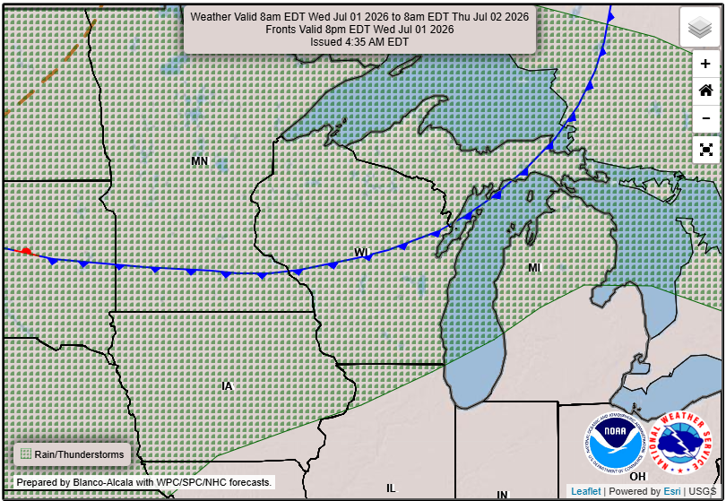
As we move into Wednesday, storm chances increase along a stationary boundary that is expected to set up across the region. Anticipate strong to severe storms with possible damaging winds and hail up to one inch. While temperatures may slightly decrease mid-week, humidity levels will remain elevated, sustaining heat impacts.
Looking Ahead
Heading into the holiday weekend, a cooling trend is expected. Highs will trend closer to seasonal averages in the low to mid 80s, although uncertainty remains regarding exact temperature values. Additional chances for rain and storms are forecast, with probabilities ranging from 30-60% for measurable precipitation.
Stay tuned for additional forecasts and safety updates as conditions evolve.
For updated forecasts where you live check out our Forecasts Page.
Source: NWS ARX and MPX Area Forecast Discussion, issued 2026-06-29T18:40:00+00:00.
