

3 Things To Know:
- Isolated showers and storms are possible this afternoon, mainly in far northeast Wisconsin.
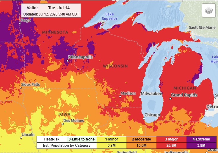
- Intense heat is expected Monday and Tuesday, with highs reaching the 90s and possible heat indices up to 105°F.
- Thunderstorm potential returns Thursday through Saturday, although specifics on severity are still unclear.
Afternoon Storm Potential
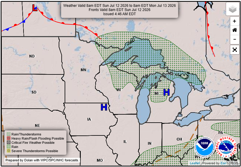
This afternoon, there’s a chance of isolated showers and storms as a lake breeze boundary could initiate some convection across far northeast Wisconsin. Weather conditions look favorable for storm development between the mid to late afternoon and into the early evening. Though storms are expected to be isolated, a few could produce strong or damaging winds and large hail.
A quote from the latest forecast discussion summarizes:
“Convection would be isolated in nature, but any storms that do form would produce strong/damaging winds and large hail.”
– NWS
Intense Heat Incoming
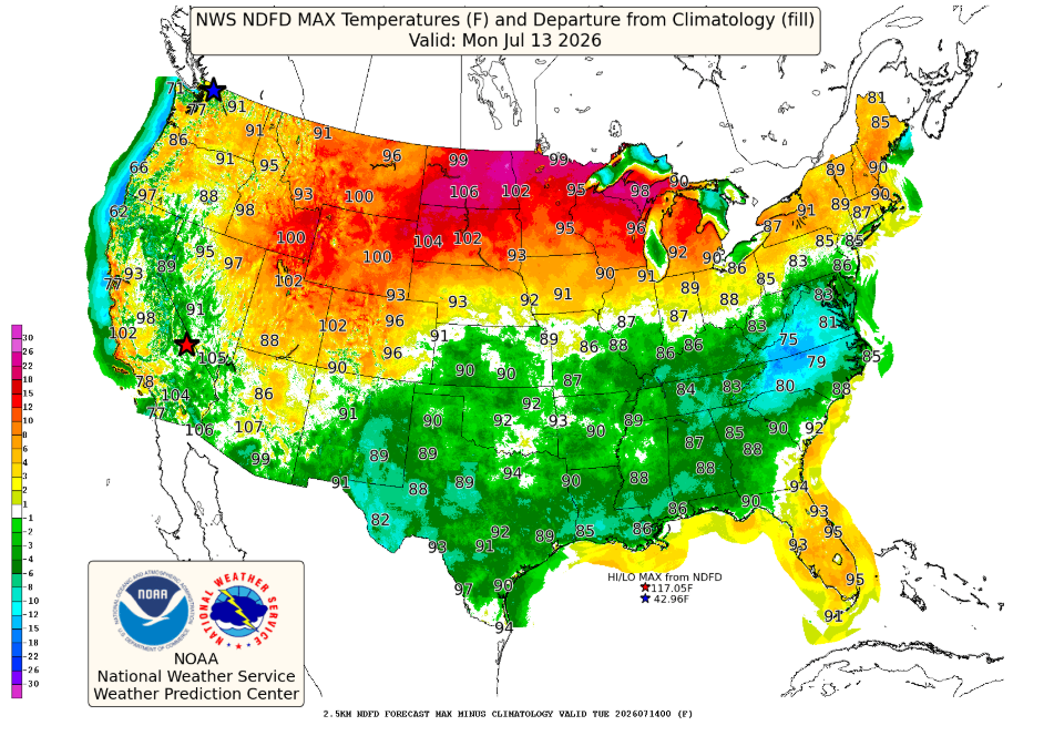
Looking ahead, Monday and Tuesday will bring intense heat across the region. High temperatures will range from the 90s to around 100°F. Some areas, especially in east-central Wisconsin, could experience heat indices as high as 105°F, leading to potential heat-related impacts. Much of the area may meet Heat Advisory criteria, and residents should take precautions during this extreme heat.
Interestingly, this marks the 90th anniversary of one of the most intense heat waves in northeast Wisconsin history, which set multiple record highs.
Unsettled Weather Ahead
After a brief cool down on Wednesday with highs in the middle 80s to lower 90s, the weather becomes more unsettled later in the week. There are chances for thunderstorms from Thursday through Saturday, but it’s too early to determine specifics regarding timing or severity.
For updated forecasts where you live check out our Forecasts Page.
Source: NWS GRB Area Forecast Discussion, issued 2026-07-12T11:24:00+00:00.
