

A prolonged stretch of dangerous heat is gripping Wisconsin, with heat alerts covering much of the state and little relief expected overnight.
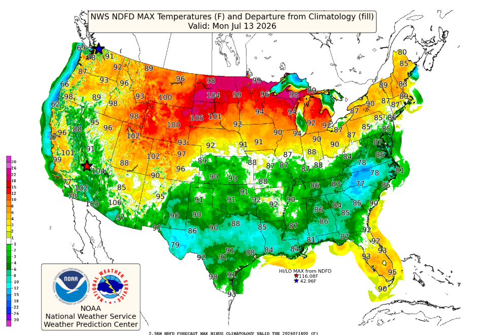
A Heat Advisory remains in effect for much of north-central, northeast and east-central Wisconsin through 9 p.m. Tuesday, while parts of west-central Wisconsin are under an Extreme Heat Warning through Thursday evening as the hottest air settles across the Upper Midwest.
The biggest concern isn’t just the daytime heat—it’s the warm nights. Temperatures will only fall into the lower 70s overnight, preventing homes and people without adequate cooling from recovering before another scorching afternoon.
Heat Advisory: Northeast and East-Central Wisconsin
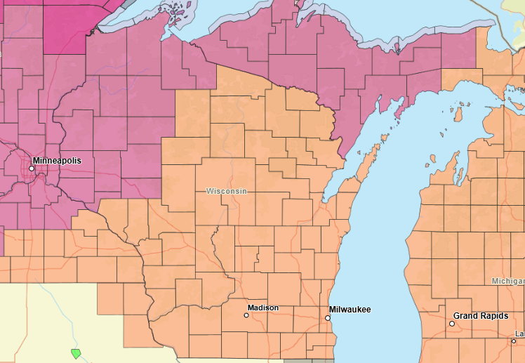
Residents from Door County and Green Bay west through Wausau and north into Vilas County should prepare for:
- Heat index values between 95 and 105 degrees
- Afternoon temperatures in the 90s to around 100
- Overnight heat indices remaining 70 to 75 degrees
- Heat Advisory in effect until 9 p.m. Tuesday
Forecasters say the highest heat index values are expected across far northeast Wisconsin.
Extreme Heat Warning: West-Central Wisconsin
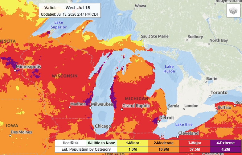
The more serious Extreme Heat Warning continues across west-central Wisconsin, including Eau Claire, Chippewa Falls, Menomonie, Rice Lake and Hudson, through 9 p.m. Thursday.
Communities under the warning can expect:
- Heat index values up to 102 degrees
- Overnight lows staying in the lower 70s
- Several consecutive days of dangerous heat with little overnight cooling
The National Weather Service warns that prolonged heat waves create cumulative heat stress, meaning the risk of heat exhaustion and heat stroke increases with each passing day if people cannot adequately cool down overnight.
Heat Peaks Tuesday
Monday and Tuesday are expected to be the hottest days across much of Wisconsin.
Even after Tuesday, the heat won’t disappear quickly. High temperatures Wednesday and Thursday are forecast to remain near 90 degrees, with heat indices reaching the upper 80s to middle 90s.
Thunderstorm chances return later this week into the weekend, though it’s too early to determine whether any storms could become severe.
Heat Safety Tips
During prolonged heat events:
- Drink plenty of water, even if you don’t feel thirsty.
- Spend time in air-conditioned buildings whenever possible.
- Avoid strenuous outdoor activities during the hottest part of the day.
- Wear lightweight, light-colored clothing.
- Check frequently on older adults, children and anyone without air conditioning.
- Never leave children or pets inside parked vehicles.
- Know the warning signs of heat exhaustion and heat stroke. Heat stroke is a medical emergency—call 911 immediately if someone becomes confused, loses consciousness or stops sweating despite extreme heat.
Bottom Line
This is the kind of heat that can become dangerous quickly, especially because temperatures will remain unusually warm overnight. If you don’t have reliable air conditioning, make plans now to spend part of the day in a cooled environment and check on family, friends and neighbors who may be more vulnerable to the heat.
You can track the forecast in your area on our Forecast page. Track the watches and warnings in your area on our Live Stream.

Great content! Keep up the good work!