

3 Things to Know
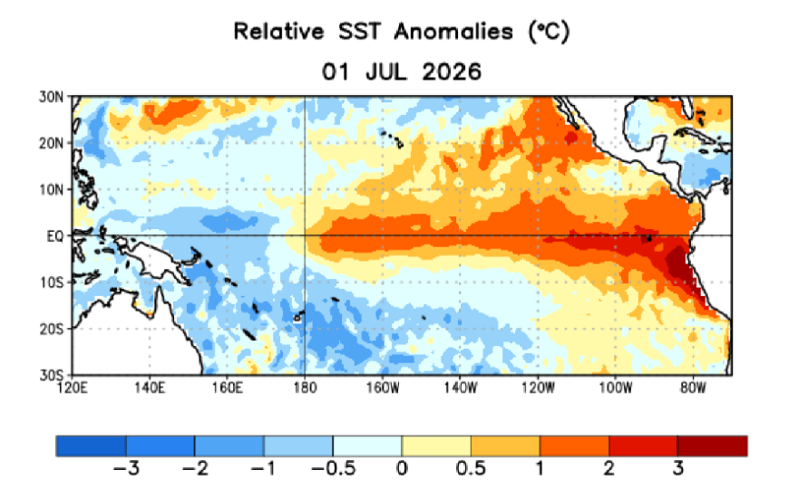
- El Niño is strengthening. Ocean and atmospheric conditions continue to reinforce the climate pattern, and forecasters expect it to intensify through the rest of 2026.
- A historic event is possible. There is an 81% chance El Niño reaches “very strong” status this fall and winter, potentially making it one of the strongest events recorded since 1950.
- Wisconsin’s weather odds may shift. A strong El Niño can favor milder winters and fewer Arctic outbreaks in Wisconsin, but it does not guarantee a specific weather pattern or snowfall outcome.
El Niño continues to strengthen across the tropical Pacific, and forecasters now say it has a high chance of becoming one of the strongest events observed in more than 75 years.
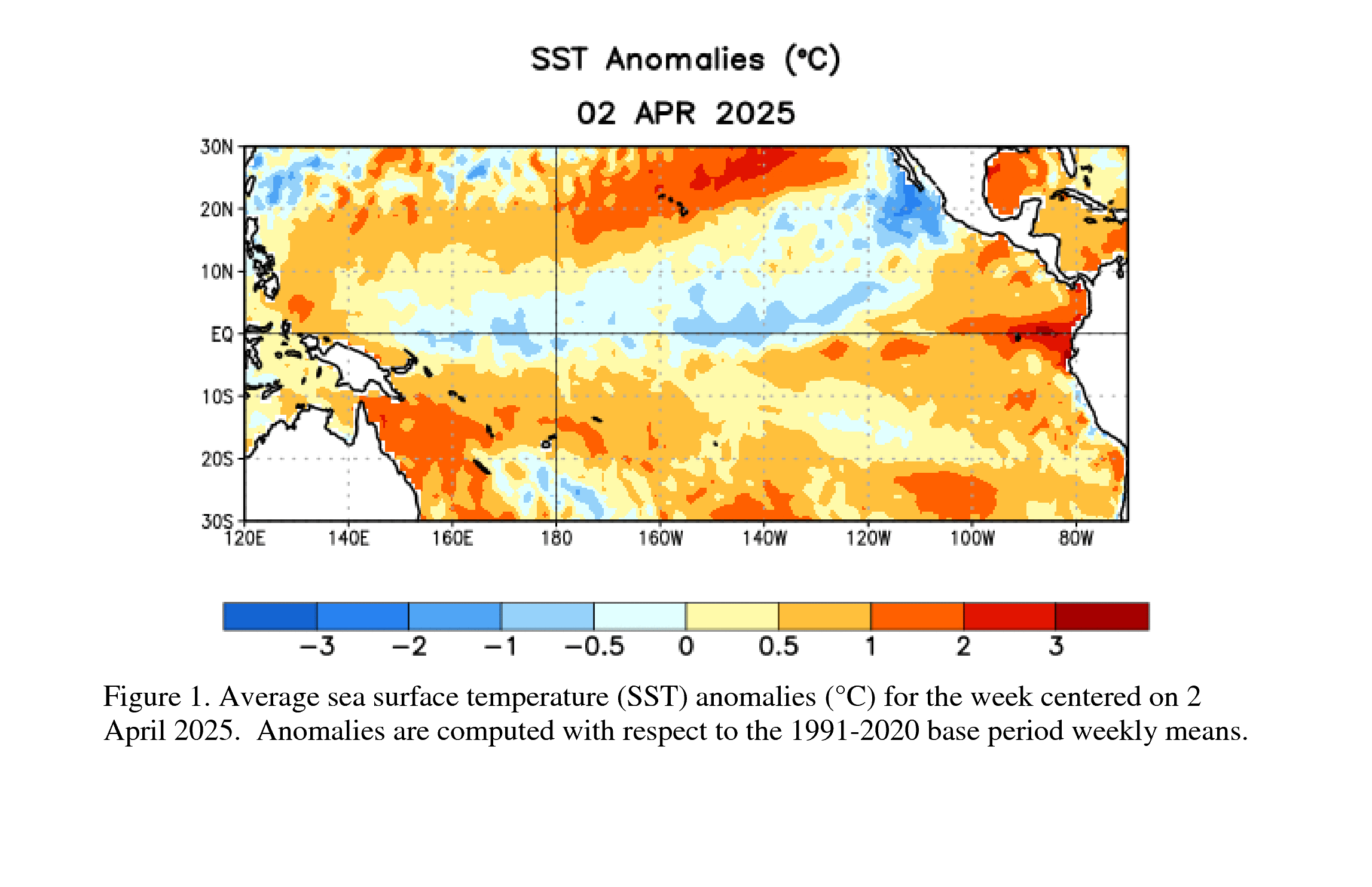
The latest update from the National Weather Service’s Climate Prediction Center shows ocean and atmospheric conditions remain firmly locked into an El Niño pattern. Sea surface temperatures have continued warming across the central and eastern equatorial Pacific, while the atmosphere is responding in ways that reinforce the event rather than weaken it.
A Strong El Niño Is Becoming Increasingly Likely
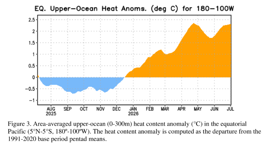
Forecasters now expect El Niño to continue strengthening through the remainder of 2026, with:
- A 97% chance El Niño will continue through early spring 2027.
- An 81% chance the event reaches very strong status during the October through December period.
- The potential for this event to rank among the strongest El Niño episodes since reliable records began in 1950.
Scientists say recent warming beneath the Pacific Ocean, driven by a downwelling Kelvin wave, has added more heat below the surface. That stored warmth is expected to continue feeding the event over the coming months.
What Does This Mean for Wisconsin?
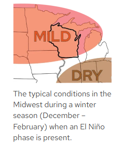
While El Niño develops thousands of miles away in the tropical Pacific, it can influence weather patterns across North America by altering the position of the jet stream.
It’s important to remember that El Niño does not guarantee specific weather outcomes. Instead, it shifts the odds toward certain temperature and precipitation patterns over an entire season.
For Wisconsin, stronger El Niño events have often been associated with:
- Milder-than-average winters
- Fewer prolonged Arctic outbreaks
- Increased storminess across parts of the southern United States
- Greater variability in precipitation depending on storm tracks
However, every El Niño is unique, and local weather can still vary significantly from historical averages.
Forecast Confidence Is Very High
Unlike earlier in the year, both computer models and current ocean-atmosphere observations are telling the same story. Forecasters say the strong agreement between observations and long-range models gives them very high confidence that El Niño will persist well into 2027.
Seasonal outlooks issued by the Climate Prediction Center will continue to refine how this developing event may influence temperatures and precipitation across the United States as autumn and winter approach.
Wisconsin Weather Now will continue monitoring the evolving El Niño and what it could mean for Wisconsin’s fall, winter and spring weather in the months ahead.
