

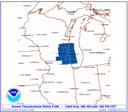
A Severe Thunderstorm Watch is in effect for southeast Wisconsin until 2 p.m. Sunday as a cluster of thunderstorms moves through the region.
3 Things to Know
- Timing: The watch remains in effect until 2 p.m. Sunday.
- Damaging winds: Stronger storms could produce wind gusts up to 70 mph.
- Hail: Isolated storms could produce hail up to 1 inch in diameter.
Storms Moving Through Southeast Wisconsin
A cluster of thunderstorms is expected to track east-southeast across the watch area through early Sunday afternoon.
The primary concern is locally damaging wind gusts. The Storm Prediction Center says scattered gusts up to 70 mph are possible, along with isolated instances of hail up to 1 inch in diameter.
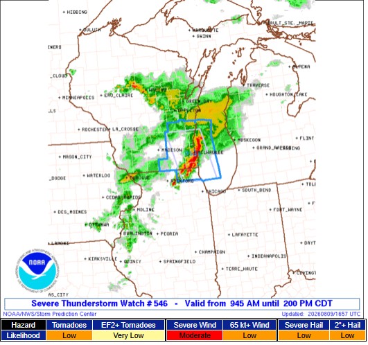
The watch area extends roughly 35 miles east and west of a line from about 50 miles north-northwest of Milwaukee to 45 miles south of Racine. Lake Michigan is also included in the watch.
What a Severe Thunderstorm Watch Means
A Severe Thunderstorm Watch means conditions are favorable for severe thunderstorms in and near the watch area. It does not mean every community will experience severe weather.
Residents should keep an eye on changing weather conditions and be prepared to act if a Severe Thunderstorm Warning is issued for their location.
Severe thunderstorms can produce damaging winds, large hail, frequent lightning and torrential rain. While tornadoes are not listed as a primary threat with this watch, severe thunderstorms can occasionally produce tornadoes.
Stay Weather Aware
With storms moving through quickly, make sure you have a reliable way to receive weather warnings through early Sunday afternoon.
If a Severe Thunderstorm Warning is issued, move indoors and stay away from windows. Secure loose outdoor objects before storms arrive if it is safe to do so.
Watch expiration: 2 p.m. Sunday, Aug. 9
Primary threat: Damaging wind gusts up to 70 mph
Secondary threat: Isolated hail up to 1 inch
Watch our Live Stream page for more.
