


3 Things To Know:
- The severe weather risk has shifted south, minimizing threats in our area tonight.
- Scattered showers are expected Tuesday morning, with afternoon temperatures cooling into the 50s and 60s.
- Patchy frost may develop in parts of central and north-central Wisconsin Tuesday and Wednesday nights.
Weather Update for Western Wisconsin
As this afternoon unfolds, the squall line that moved through last night is now positioned well south of our area, primarily affecting regions along the Interstate 70 corridor. Here in western Wisconsin, we’re experiencing cooler temperatures following this departure, with warmer, more humid air confined to the lower 80s south of the line.
“Due to this, we’ve seen a reduction in the instability available for storms tonight, lowering the severe weather threat,” says the National Weather Service. The Slight Risk for severe weather has now been shifted south of Interstate 90, leaving only a Marginal Risk from I-90 to Upper Michigan.
Severe Risk Update For Monday night
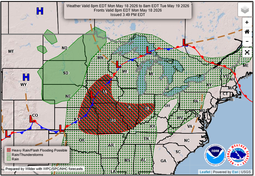
Monday night, we can expect scattered thunderstorms mainly in the southern part of the region, with the primary threat being damaging winds. If any severe weather occurs, it is expected to happen between 3 PM and 7 PM CDT. The confidence is lower than earlier forecasts suggested, which is good news for those concerned about severe weather.
Looking Ahead to Tuesday
As we move into Tuesday, a northern stream shortwave trough will bring scattered morning showers. High temperatures will occur around midnight in the mid- and upper 60s before dropping significantly into the 50s and 60s during the day due to strong cold air advection.
Frost Risk Midweek
Tuesday night and Wednesday night, conditions will be conducive to colder temperatures in the 30s and 40s, particularly in traditional cooler areas of central and north-central Wisconsin. This may lead to patchy frost, so make sure to protect sensitive plants if you’re in these zones.
Weekend Outlook
In the days ahead, a northern stream shortwave will approach the region, paving the way for showers and storms throughout the weekend. However, organized severe weather is unlikely due to lower wind shear levels.
Stay connected for ongoing updates. For updated forecasts where you live, check out our Forecasts Page.
Source: NWS ARX Area Forecast Discussion, issued 2026-05-18T18:20:00+00:00.
