
3 Things To Know:
- Expect warm and dry weather through Thursday.
- Thunderstorms are likely late Thursday night through Saturday.
- Some storms could be severe, particularly Friday morning.
The weather in Southeast Wisconsin is transitioning to a warm pattern with low relative humidity ahead of a series of incoming storms. Based on the latest Area Forecast Discussion from the National Weather Service Milwaukee/Sullivan, here’s what you can expect in the coming days.
Warm and Dry Weather
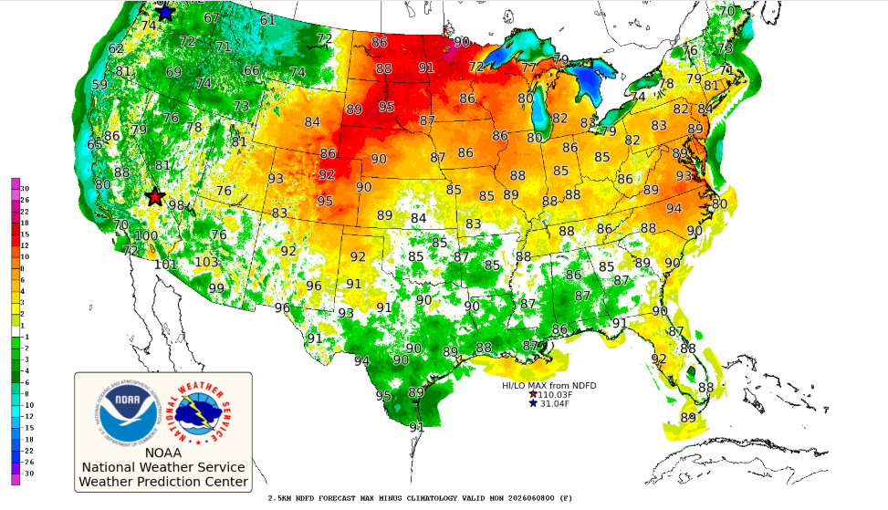
Today and Thursday will be characterized by calm winds and clear skies in the morning, with the introduction of a southwest breeze. High temperatures today will reach the mid-70s in Milwaukee due to a lake breeze, while inland areas warm into the lower 80s. As we move into Thursday, temperatures are expected to rise further, hitting the mid to upper 80s across the region, including lakeshore areas south of Port Washington. Dewpoints will remain relatively low in the 40s, meaning heat index values should remain close to actual air temperatures.
Thunderstorms on the Horizon
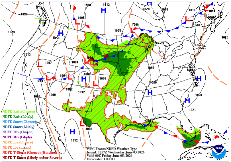
As we head into Thursday evening, conditions will change significantly. A low-pressure system from the Northern Plains will enhance moisture influx into the area, with precipitable water values expected to jump from around half an inch to almost 1.75 inches. This increase in humidity will lead to a rise in dewpoints into the upper 50s Thursday and lower 60s Friday, making it more conducive for thunderstorm activity.
The forecast indicates that a complex of thunderstorms could develop late Thursday night, tracking through southern Wisconsin by Friday morning. The best chances for severe storms are related to organized thunderstorm activity, with the potential for strong winds and the possibility of hail. In a less organized scenario, beneficial rainfall is still anticipated.
What to Expect This Weekend
Thunderstorms will persist throughout Friday, influenced by a stationary upper jet over southern Wisconsin. Showers and storms may continue into Saturday morning until a cold front passes through around midday.
For those planning outdoor activities, Saturday’s weather will follow a shift as high pressure builds in, but we could still see lingering shower and storm activity early. Expect drier conditions for Sunday and Monday before another system moves in, potentially bringing more rain and storms for Tuesday and Wednesday.
As stated in the discussion, “The weak ripples in the mid-level flow will still be over central/southern WI all day Friday,” which keeps our chances for showers and thunderstorms elevated through the weekend.
Marine Forecast
If you’re heading out on Lake Michigan, be advised that a Small Craft Advisory is in effect from Thursday afternoon through Thursday evening due to rising waves and gusty winds. Conditions will improve after the frontal passage on Saturday afternoon.
For updated forecasts where you live check out our Forecasts Page.
Source: NWS MKX Area Forecast Discussion, issued 2026-06-03T11:00:00+00:00.