
3 Things To Know:
- Expect scattered showers and thunderstorms this afternoon and evening, with potential for strong storms.
- Marine dense fog may affect nearshore areas, impacting boaters.
- Above normal temperatures are expected next week, with heat indices potentially exceeding 100 degrees.
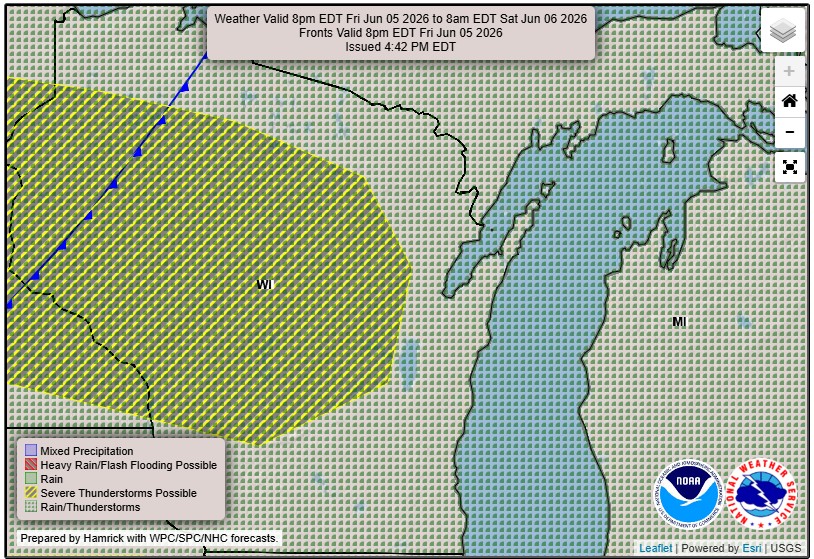
Storms This Afternoon and Evening
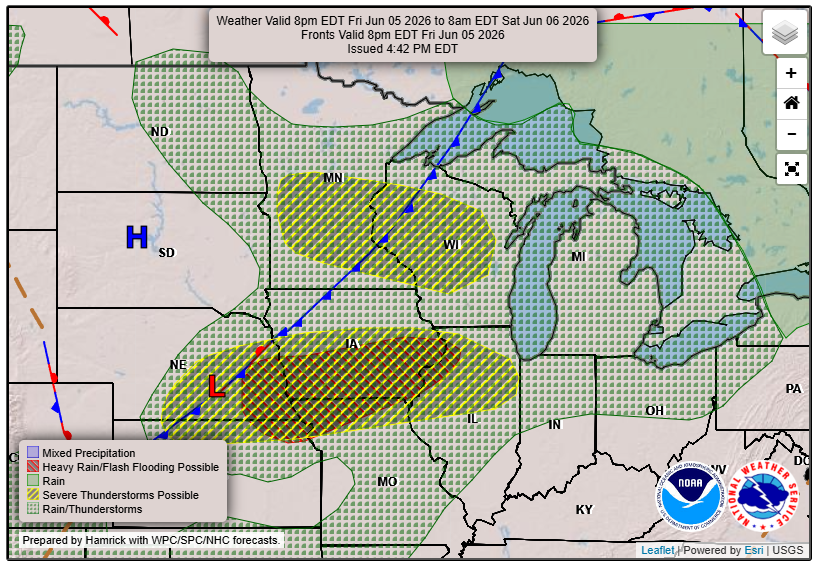
This afternoon, we are anticipating scattered showers and thunderstorms moving across Northeast Wisconsin from west to east. The potential exists for these storms to become strong or severe, with damaging winds and hail up to 1 inch being the main concerns.
As storms approach, the timing looks to start in the mid to late afternoon for central and north-central Wisconsin, while the Fox Valley may see activity later in the evening. The steep lapse rates and instability suggest that certain areas could experience heavy rainfall, possibly exceeding an inch in localized spots.
“Active weather will be the main focus of the forecast today.” – NWS
Marine Fog Alert
Warm, moist air moving over Lake Michigan is expected to create areas of dense fog along the shoreline. This may impact visibility for boaters, so extra caution is advised out on the water this afternoon and evening.
Temperatures on the Rise
Looking ahead, warm conditions will persist, with high temperatures likely reaching the 90s by next week. This could lead to increased heat-related impacts, especially on Wednesday and Thursday afternoons when heat indices may exceed 100 degrees in parts of central Wisconsin and the Fox Valley. Be prepared for potentially dangerous conditions as the week progresses.
Stay Informed
As we continue to monitor these weather conditions, make sure to stay updated on the latest forecasts in your area. For updated forecasts where you live check out our Forecasts Page.
Source: NWS GRB Area Forecast Discussion, issued 2026-06-05T18:46:00+00:00.