
3 Things To Know:
- A humid air mass will remain over the region throughout the week.
- Showers and thunderstorms may bring heavy rainfall this evening, with localized flooding possible.
- Hot conditions mid to late week may lead to Heat Advisory levels on Wednesday.
Weather Overview
As we move through the week in Southeast Wisconsin, a very humid air mass will linger, bringing a mix of showers and storms. This evening, expect thunderstorms to develop, particularly due to a compact area of circulation moving through eastern Iowa. The tropical-like atmosphere may lead to heavy downpours, potentially causing localized flooding.
“Very heavy downpours will be possible with any thunderstorms that occur this evening owing to the tropical environment that will be present.”
Timing and Rainfall
Showers are expected to increase late this afternoon into the evening. For most areas, rainfall totals will generally range from 0.1 to 0.5 inches, but localized spots under stronger storms may see totals up to 3 inches. Keep an eye out for possible funnel clouds and gusty winds as storms develop.
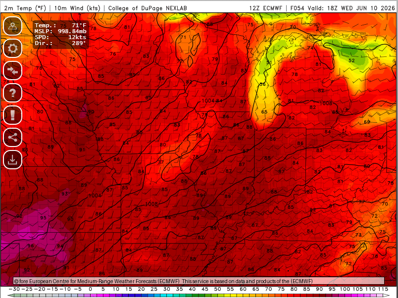
Midweek Heat and Severe Thunderstorms
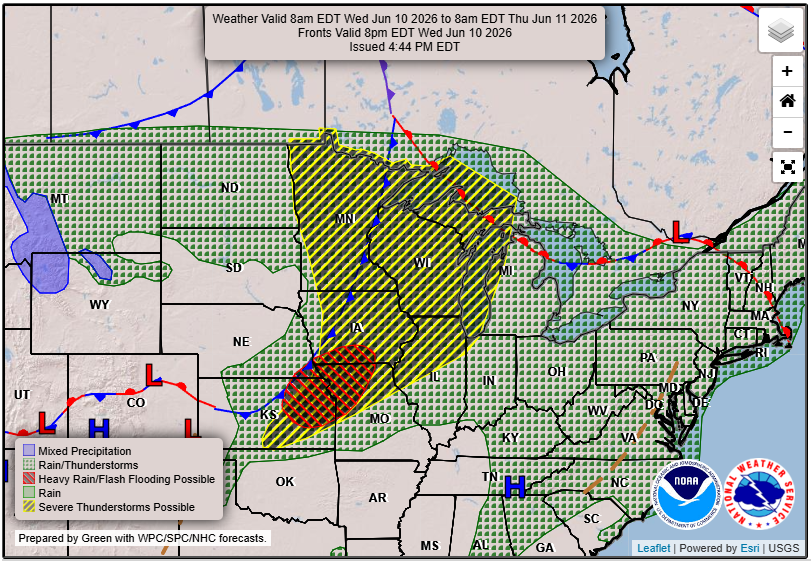
As we move into Wednesday, conditions will heat up considerably, with temperatures climbing into the low 90s and dew points remaining high. Heat indices could approach 100 degrees, which may trigger a Heat Advisory. Thunderstorms are anticipated Wednesday evening as a front approaches, and there is a potential for severe weather, including hail and high winds.
Looking Ahead
Thursday also holds a chance for severe thunderstorms as remnants from the previous day’s storm set up a boundary for new storm development. Beyond this, we can expect to see slightly cooler and drier conditions settling in by next weekend.
For updated forecasts where you live check out our Forecasts Page.
Source: NWS MKX Area Forecast Discussion, issued 2026-06-08T20:10:00+00:00.