
3 Things To Know:
- Scattered showers and thunderstorms are likely into Tuesday evening.
- Severe storms possible on Wednesday, particularly in western areas.
- Temperatures remain above normal, with heat indices reaching the mid-90s.
Your Weather Outlook
Northeast Wisconsin is bracing for scattered showers throughout the night, as warmer air continues to push into the region. While initial rainfall amounts have been light, expect heavier totals once thunderstorms develop later.
“Any convection will be able to produce a lot of rain very quickly, which will pose a flooding concern…”
Timing of Showers and Storms
After an initial round of showers, we might see a brief lull in precipitation later today. However, an upper-level disturbance is expected to bring more showers and possibly thunderstorms tonight. Watch for localized heavy rainfall, particularly in central Wisconsin, which is currently at a Slight Risk for Excessive Rainfall.
Tuesday and Wednesday Storms
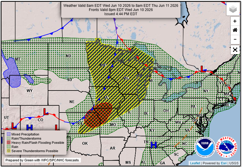
Tuesday brings a mix of sun and clouds, with temperatures reaching the mid-80s. Conditions are ripe for storm development by the afternoon, especially along a warm front extending from central Minnesota into northern Illinois. Central Wisconsin and portions of the Fox Valley are under a Marginal Risk for severe weather. Strong winds are the primary concern, as storms may weaken when moving north into these areas.
On Wednesday, we’re looking at a higher likelihood of severe storms. The late afternoon to early evening is when we’re expecting more intense weather, as a cold front approaches. Best chances include damaging winds, hail, and even the potential for tornadoes. Heavy rainfall is likely, with total accumulations expected to exceed an inch in some spots.
Above Normal Temperatures
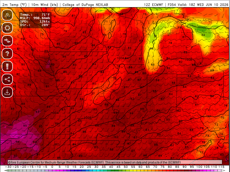
Alongside the active weather, temperatures will remain above normal for early June. Highs will range from the upper 70s on Tuesday to mid-80s on Wednesday, with heat indices potentially reaching the mid-90s. Stay alert as conditions could change quickly, especially with storms in the forecast.
As we navigate through this week’s weather, be sure to stay informed and prepared. For updated forecasts where you live check out our Forecasts Page.
Source: NWS GRB Area Forecast Discussion, issued 2026-06-08T19:43:00+00:00.