
3 Things To Know:
- Thunderstorms are likely this evening and overnight, with potential for severe weather Wednesday afternoon.
- Expect near to below normal temperatures for the week, warming up significantly by the weekend.
- There is a 20-40% chance of additional showers and storms Thursday.
The weather in Northeast Wisconsin is gearing up for a change as we head into this evening. According to the latest discussion from the National Weather Service Green Bay,
“Next chance for widespread showers and thunderstorms arrive later this evening and overnight, then continuing on Wednesday.”
For today, we’ll see comfortable highs in the middle to upper 70s. However, conditions are set to shift as showers and thunderstorms move in later this evening, particularly across central and north-central Wisconsin.
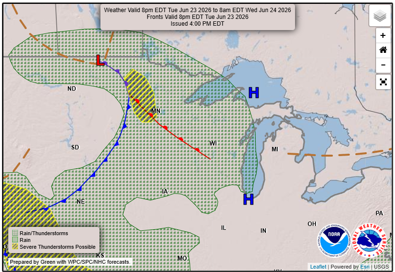
The arrival times may vary, with some models indicating an earlier start than others.
Severe Weather Outlook
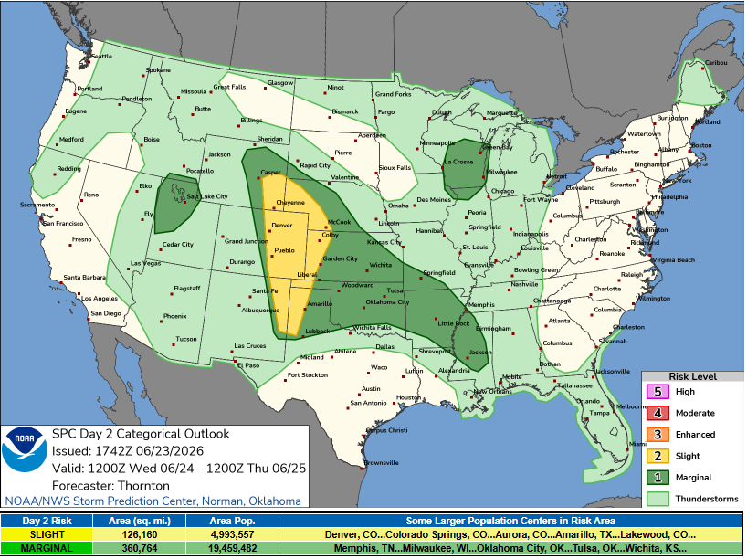
Wednesday afternoon into early evening carries a Marginal Risk for severe thunderstorms, mainly along or south of a line from Tomahawk to Sturgeon Bay. The potential for severe weather is supported by a mix of instability and wind shear. Expect localized heavy rainfall, with the possibility of some areas receiving up to 1 inch.
An Unsettled Thursday
Looking ahead to Thursday, there will still be a chance for instability showers and storms, with a predicted 20-40% likelihood. However, severe weather is not anticipated.
Warmer Weekend Ahead
By the weekend, expect the return of more typical summer-like conditions with warmer temperatures. Stay tuned for further updates, as the increasing heat may bring additional chances for thunderstorms through early next week.
For updated forecasts where you live check out our Forecasts Page.
Source: NWS GRB Area Forecast Discussion, issued 2026-06-23T18:11:00+00:00.