

MILWAUKEE — One year after historic flooding swamped parts of southeastern Wisconsin, the National Weather Service is taking a detailed look back at the extraordinary rainfall, how the event developed and what forecasters learned from it.
Repeated thunderstorms during the evening of Aug. 9 and early morning of Aug. 10, 2025, produced widespread flash flooding across Milwaukee, Ozaukee, Washington and Waukesha counties.
The numbers show just how unusual the event was.
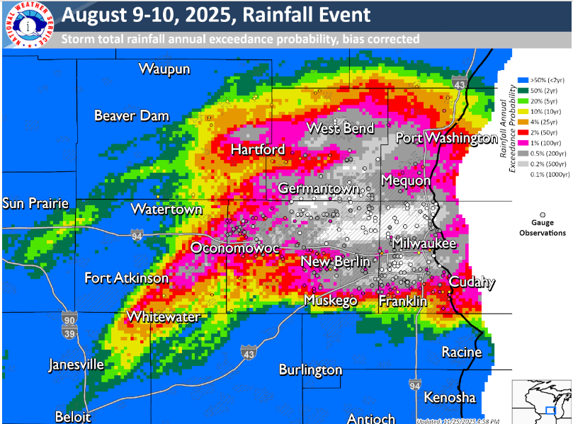
A rain gauge at James Madison High School on Milwaukee’s northwest side measured 14.55 inches of rain in 24 hours, establishing a new Wisconsin record. The previous record was 11.72 inches near Mellen in June 1946.
Milwaukee Mitchell International Airport recorded 5.74 inches on Aug. 9, making it the second-wettest calendar day in Milwaukee records dating to 1871.
Flooding By the Numbers
- 14.55 inches: New Wisconsin 24-hour rainfall record
- 5.74 inches: Rain measured at Milwaukee Mitchell International Airport
- 20: Flash flood and flood warnings issued during the event
- $170 million: Estimated flood damage across four southeastern Wisconsin counties
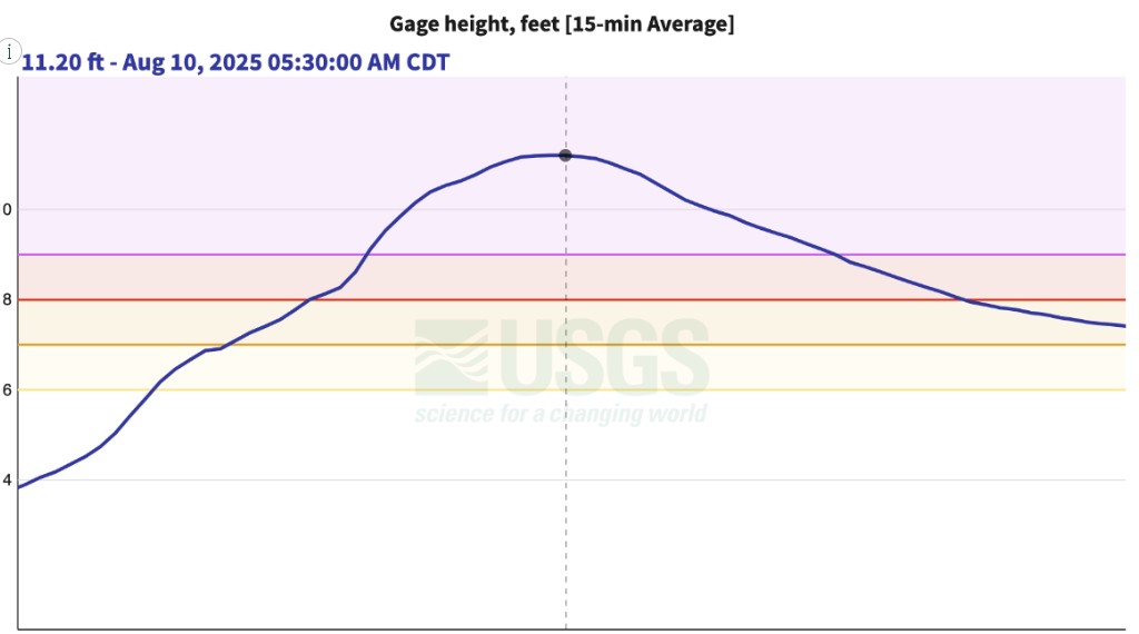
- 16,000 cubic feet per second: Estimated peak flow of the Milwaukee River at Estabrook Park
Some of the most extreme rainfall had an estimated return interval of 500 to 1,000 years, particularly across northern Milwaukee County and portions of Ozaukee, Washington and Waukesha counties.
That does not mean such rainfall can only happen once every 1,000 years. A 1,000-year rainfall event refers to an estimated 0.1% chance of that amount of rain occurring at a particular location in any given year.
Why So Much Rain Fell
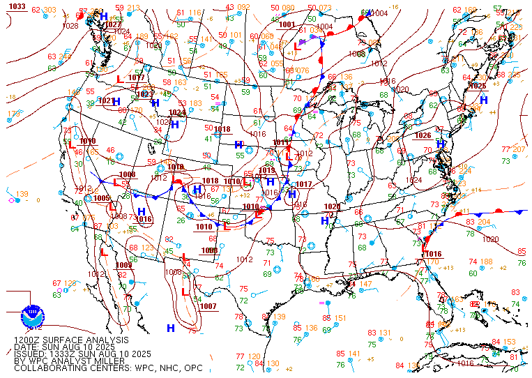
The atmosphere was loaded with moisture heading into the event. The NWS said precipitable water values reached roughly 1.5 to 2.5 inches while atmospheric instability was more than sufficient to support strong thunderstorm development.
The critical ingredient became a low-level jet that transported additional moisture into southeastern Wisconsin and helped thunderstorms repeatedly develop over the same areas.
An outflow boundary left behind by an earlier round of storms also helped focus new thunderstorm development.
Instead of one line of storms simply moving through, storms repeatedly formed and moved across portions of the Milwaukee metro. At the height of the event, rainfall rates reached an extraordinary 3 to 5 inches per hour.
Roads quickly became impassable, vehicles were stranded and water rescues were reported. Basements and underground parking structures flooded while rivers and streams rose rapidly.
Several waterways set records. The Menomonee River at Menomonee Falls, Kinnickinnic River in Milwaukee and Milwaukee River at Estabrook Park all reached record crests.
Forecast Changed Quickly
The event also demonstrated one of the biggest challenges of forecasting extreme rainfall.
Computer models had identified the potential for significant rain and flooding before the event, but initially focused the greatest threat farther west across south-central and southwestern Wisconsin.
By the evening of Aug. 9, newer forecast information increasingly pointed toward southeastern Wisconsin.
The NWS expanded its Flood Watch to include the entire southeastern Wisconsin area at 6:57 p.m. The first Flash Flood Warning covering much of Milwaukee County and eastern Waukesha County followed at 8:04 p.m.
Thunderstorms then repeatedly redeveloped through the night.
New Forecast Tools Could Help
The NWS also highlighted the experimental Warn-on-Forecast System, or WoFS, which combines frequently updated modeling, radar information and other prediction techniques.
During the flooding event, WoFS began showing the possibility of localized rainfall exceeding 7 inches and eventually indicated that isolated totals greater than 10 inches were possible.
The model did not perfectly pinpoint where the heaviest rain would occur, but the NWS says tools like WoFS may eventually help meteorologists recognize rapidly developing extreme-weather scenarios and adjust forecasts and warnings more quickly.
The August 2025 flood ultimately became one of the most significant rainfall events in Wisconsin history and a reminder that extreme flash flooding can develop quickly when thunderstorms repeatedly track over the same area.
Source: National Weather Service Milwaukee/Sullivan
