
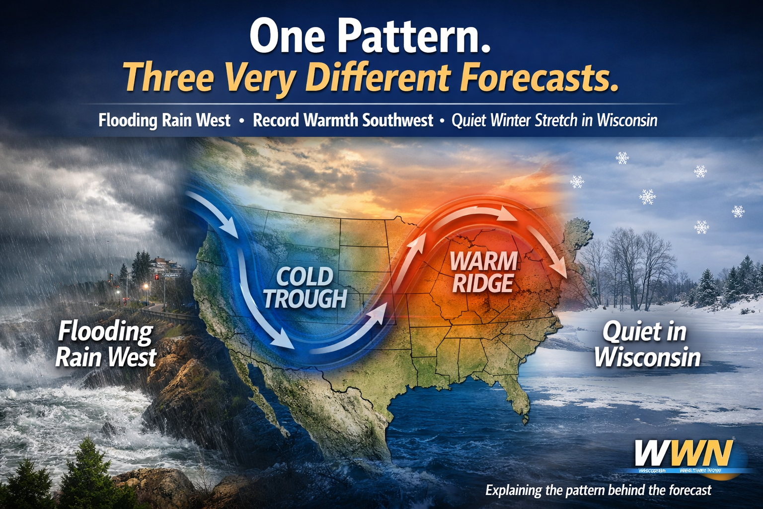
Why California Gets Flooding Rain While Wisconsin Stays Quiet
- Big contrast nationwide: Atmospheric rivers soak California while record warmth spreads across the Southwest and Plains.
- Wisconsin stays quieter: Limited moisture and weak disturbances favor light snow chances and a brief cold shot before temperatures moderate.
- What could change: Forecasters are watching late-week Pacific energy and shortwave timing that could impact Wisconsin after Christmas.
Atmospheric rivers continue to aim at the West Coast, delivering rounds of heavy rain and mountain snow. Meanwhile, Wisconsin sits downstream of weaker upper-level energy with limited moisture to work with.
“Without a strong moisture source, Midwest systems struggle to produce more than light snow or nuisance precipitation.”
Shortwaves moving through the northern tier may still trigger light snow at times, especially early in the week, but signals for high-impact winter storms remain low.
Cold Air Sneaks In, Then Backs Off
Wisconsin and the Great Lakes will feel a brief shot of colder-than-average air Sunday, tied to a shallow upper trough crossing the eastern U.S. That chill shifts east by Monday, allowing temperatures to trend closer to normal as Christmas approaches.
Meanwhile, record or near-record warmth spreads across the Southwest and Plains, with some locations running 20 to 30 degrees above average.
“This sharp temperature contrast is a hallmark of a locked-in ridge-trough pattern.”
What Forecasters Are Watching Closely
While confidence is high in the overall pattern, meteorologists are keeping a close eye on a few key details that could still affect Wisconsin’s forecast after Christmas.
1. Timing of Northern-Tier Shortwaves
Small changes in timing could determine whether Wisconsin sees flurries or light accumulating snow.
2. Strength of Pacific Energy Later Next Week
If energy ejects farther east than expected, storm chances could increase beyond the current forecast window.
3. Temperature Trends Heading Into Late December
Moderation looks likely, but the depth of cold air available later in the month remains uncertain.
“The pattern favors quieter weather now, but late December often rewards patience.”
The Bottom Line for Wisconsin
For now, Wisconsin remains on the low-impact side of a very active national weather pattern.
- A colder start to the week
- Light snow chances at times, mainly nuisance-level
- No strong signals for major winter storms before Christmas
That may not deliver blockbuster winter weather, but for holiday travel and plans, it’s a welcome break.