
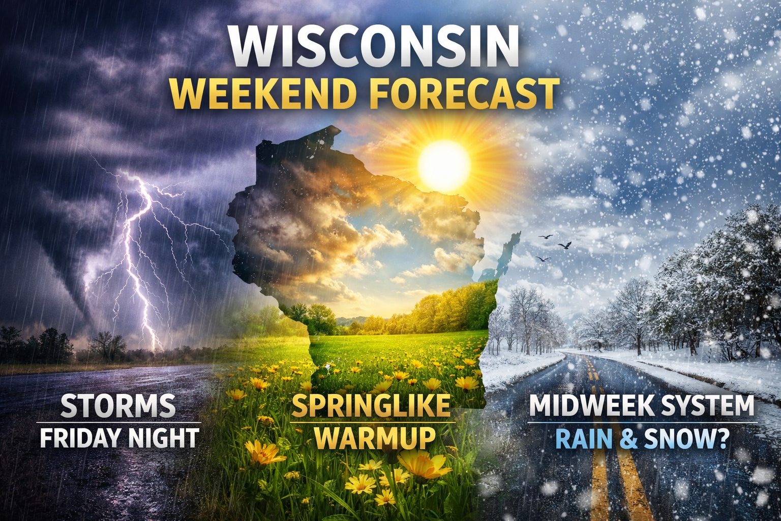
Strong storms and heavy rain exit Wisconsin Saturday, followed by a warm and breezy Sunday and Monday with temperatures in the 60s. Another system could bring rain or snow by midweek.
After a stormy end to the workweek, Wisconsin’s weekend forecast is shaping up in two very different parts. The first half of the story is Friday night’s active weather, with rounds of rain, thunderstorms, localized flooding concerns, and even a few strong to severe storms in parts of the state. The second half is a much quieter and much warmer stretch for Sunday and Monday, when temperatures surge well above early March averages before another system brings rain and possible wintry mix back into the picture by Tuesday and Wednesday.
Forecast discussions from Milwaukee, Green Bay and La Crosse all point to periods of heavy rain and thunderstorms pushing through overnight, with the strongest storms capable of producing gusty winds, hail and an isolated tornado.
For much of Wisconsin, the immediate concern is the tail end of Friday night’s storm system. Forecast discussions from Milwaukee, Green Bay and La Crosse all point to periods of heavy rain and thunderstorms pushing through overnight, with the strongest storms capable of producing gusty winds, hail and an isolated tornado, especially across southern and western parts of the state. With frozen or partially frozen ground still in place in some areas, runoff will be efficient, raising the risk for ponding on roads, urban flooding and rises on rivers and streams.

Southern Wisconsin: Stormy Start, Quieter Saturday
In southern Wisconsin, including Milwaukee, Madison and Kenosha, the strongest thunderstorms are expected Friday night before conditions improve early Saturday. The National Weather Service in Milwaukee says the main line of stronger storms should sweep east during the overnight hours, with lighter rain lingering into early Saturday morning before ending.
By Saturday afternoon, the severe threat will be over, but the air behind the system will feel cooler. Highs should still reach the 50s in many spots before temperatures slip back into the 40s Saturday evening. A few leftover showers are possible in the morning, but most of the day looks quieter and far less active than Friday night.
Northeast Wisconsin: Fog, Flooding Concerns And A Brief Wintry Mix North
Dense fog may continue to create travel issues at times into Saturday morning, especially near Lake Michigan.
Across northeast Wisconsin, including Green Bay, the Fox Valley and lakeshore communities, the forecast carries a few extra complications. Dense fog may continue to create travel issues at times into Saturday morning, especially near Lake Michigan. Rain and thunderstorms are expected to move through late Friday night into early Saturday, with localized flooding possible where the heaviest rain falls in a short period of time.
Far north-central Wisconsin has the best chance to see a brief wintry mix late Friday night into Saturday morning. Forecast guidance suggests some freezing rain, sleet or wet snow could mix in before precipitation tapers off, but accumulations look light for now. The bigger story in northern and northeastern parts of the state may be the effect of rain and warmer air on river ice, increasing the threat for ice jams and localized flooding through the weekend and into early next week.
Western Wisconsin: Strong Storm Risk Fades, Warmth Returns Fast
Western Wisconsin, including La Crosse and surrounding areas, faces a similar overnight setup with strong to severe storms possible Friday evening, especially between about 8 p.m. and 11 p.m. The main threats there include large hail, damaging winds and a low tornado risk, along with rapid runoff from heavy rain falling on frozen ground.
Once that system pulls out, the warmup arrives quickly. Forecast discussions indicate highs climbing back into the 50s and lower 60s by Sunday, with mild air holding into Monday as well. That means western Wisconsin will go from severe storm concerns to springlike temperatures in less than 48 hours.
Sunday And Monday: The Best Stretch Of The Forecast

Statewide, Sunday and Monday look like the standout days in the forecast. Southern Wisconsin could reach the upper 50s to mid 60s Sunday, then push into the mid 60s and possibly near 70 Monday if the warmer air fully mixes to the surface. Northeast Wisconsin is also expected to turn very warm and breezy, with some communities likely reaching the 60s.
That warmth will not come quietly. Gusty southwest winds are expected Sunday, especially across eastern Wisconsin and near the bay and lakeshore. In northeast Wisconsin, stronger winds may also shift weakened ice and create additional concerns for ice floes along Green Bay and nearby shorelines.
Early Next Week: Cooler Tuesday, Then Watching A Midweek System

The mild stretch starts to ease back Tuesday as a front pushes through the region. Temperatures should settle closer to normal, though the exact numbers will depend on where that boundary stalls. Even then, the pattern stays active.
All three forecast offices are watching another system for Tuesday into Wednesday. Right now, rain looks likely to return to much of Wisconsin, but the track of the storm will determine who sees plain rain and who ends up dealing with a rain-snow mix or even accumulating snow. Northern Wisconsin has the highest chance of seeing more meaningful snow potential, while southern Wisconsin currently appears more likely to stay mainly on the rainy side, though some wintry mix cannot be ruled out as the system exits.
The Bottom Line
Wisconsin’s weekend forecast is a tale of two seasons. Friday night brings the last blast of active weather, including heavy rain and strong thunderstorms, but by Sunday and Monday the state swings back to a much warmer, almost springlike pattern with highs in the 50s and 60s. That break will be brief, though, as another system arrives by Tuesday and Wednesday with the potential to bring rain, a wintry mix, or snow depending on where you are in the state.