
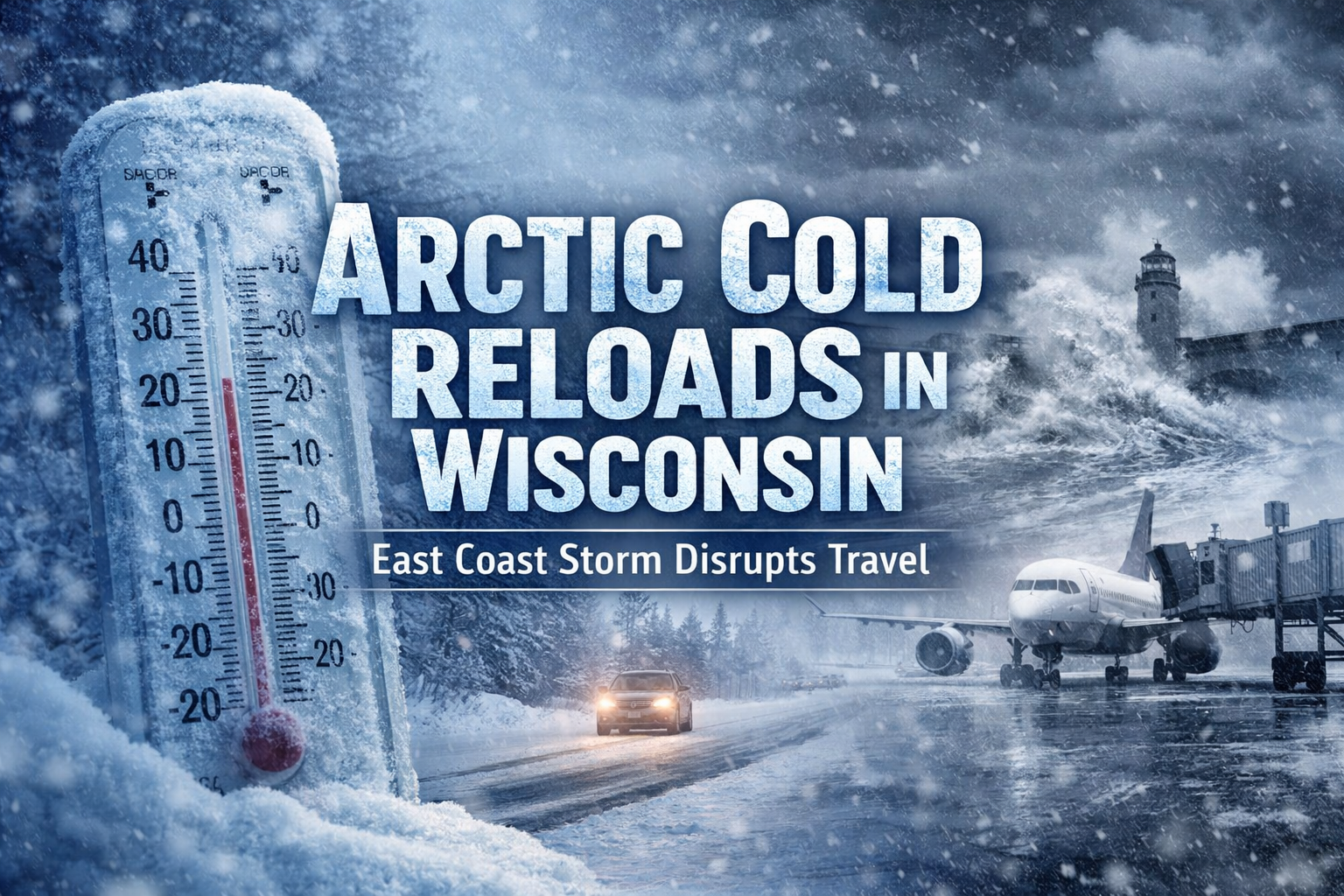
Travel impacts likely for anyone heading to the East Coast while Wisconsin avoids a major snowstorm, but gets renewed Arctic air keeping dangerous cold locked in to disrupts travel this weekend.
- Travel remains mostly manageable in Wisconsin but travelers connecting through East Coast airports could see delays due to storm-related disruptions.
- Wisconsin avoids this weekend’s major East Coast winter storm, but a renewed surge of Arctic air will keep dangerously cold temperatures locked in through early next week.
- Prolonged snow cover may enhance overnight cooling, increasing the risk of bitter wind chills and record-challenging cold across parts of the state.
Wisconsin travel won’t be in the path of this weekend’s high-impact East Coast winter storm, but residents will still feel its effects — just in a different way.
While heavy snow, high winds and coastal flooding target the Eastern Seaboard, a renewed surge of Arctic air will reinforce dangerously cold conditions across Wisconsin and much of the Upper Midwest. The cold is expected to persist into next week, with wind chills remaining well below zero at times.
“Frigid surface high pressure will be replenished with renewed surges to maintain dangerously cold temperatures and continued record values possible for portions of the Central and Eastern U.S.”
— Weather Prediction Center, Extended Forecast Discussion
Make sure to bookmark our Forecast page and check back frequently for updates.
Why the Cold Won’t Let Go
According to the Weather Prediction Center, the overall weather pattern remains locked in an amplified configuration, allowing repeated injections of Arctic air to spill southward. Snow and ice already on the ground across parts of Wisconsin will help the cold linger even longer by enhancing overnight radiational cooling.
This means nighttime lows will continue to fall quickly after sunset, and daytime temperatures will struggle to recover, especially away from Lake Michigan.
While Wisconsin avoids a major snowstorm, weak clipper systems embedded in the flow may still bring occasional light snow chances, particularly across north-central Wisconsin and the Great Lakes region. These systems typically produce minor accumulations but can still lead to slick roads and reduced visibility.

Travel Impacts: Midwest Quiet, Coasts Chaotic
Locally, travel conditions across Wisconsin are expected to remain relatively manageable compared to the East Coast, where a rapidly strengthening coastal storm is forecast to disrupt air and ground transportation from the Carolinas through New England this weekend.
However, Wisconsin travelers connecting through East Coast airports should prepare for delays and cancellations. Even if local weather is quiet, ripple effects from major coastal storms often extend far beyond the immediate impact zone.
Drivers across Wisconsin should remain cautious during the cold stretch, as repeated freeze-thaw cycles and occasional light snow can create patchy icy conditions, especially during the morning and evening commute.
What Storm to Watch Next
The key takeaway for Wisconsin is not one single storm, but the persistence of the pattern. As long as Arctic high pressure continues to reload, cold-related impacts — from energy demand to vehicle reliability — will remain the primary concern.
Forecast confidence is increasing that temperatures will stay well below average into early February, with any meaningful moderation likely to be slow and gradual.
Stay tuned for updates as forecasters refine timing for any clipper snow chances and monitor how long this prolonged cold pattern holds its grip on the region.