
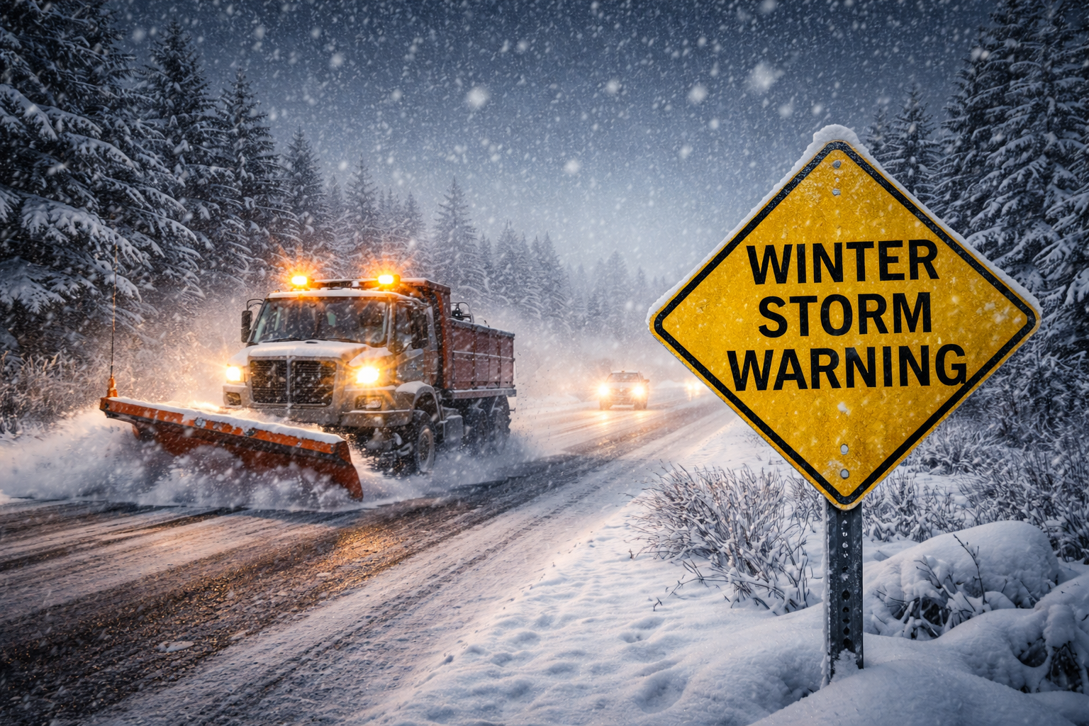
Winter storm warning and advisory issued for northern Wisconsin. Snow, sleet and ice arrive tonight with gusts up to 45 mph.
Northern Wisconsin is bracing for a messy, high-impact winter storm that will bring snow, sleet, freezing rain and strong winds beginning tonight and lasting into Wednesday — and in some areas, into Thursday.
3 Things to Know
- Winter weather advisory from 9 p.m. tonight to noon Wednesday for Vilas, Forest, Florence and northern Marinette counties
- Winter storm warning from 9 p.m. tonight to noon Thursday for Douglas and Bayfield counties
- Snow totals of two to eight inches, light ice and wind gusts up to 45 mph could make travel difficult
Advisory Area: Snow, Sleet and Ice Late Tonight
The National Weather Service Green Bay has issued a winter weather advisory for Vilas, Forest, Florence and northern Marinette counties from 9 p.m. tonight through noon Wednesday.
Forecasters say,
“Mixed precipitation expected. Total snow and sleet accumulations between 2 and 6 inches and ice accumulations of less than one tenth of an inch. Winds gusting as high as 35 mph.”

That mix of heavy, wet snow and light icing could create slick roads and strain trees and power lines. The advisory also warns,
“Plan on slippery road conditions. The hazardous conditions will impact the Wednesday morning commute.”
In northern Forest, Florence and northern Marinette counties, the combination of wet snow and gusty winds could lead to isolated power outages.
Warning Area: Heavier Snow Near Lake Superior
Farther northwest, the situation becomes more serious.
The National Weather Service Duluth has issued a winter storm warning for Douglas and Bayfield counties from 9 p.m. tonight through noon Thursday.
The warning states,
“Heavy snow with light ice accumulations expected. Total snow accumulations of 5 to 8 inches for northern Douglas and Bayfield Counties, elsewhere between 2 and 4 inches of snow. Ice accumulations around one tenth of an inch. Winds gusting as high as 45 mph.”
Travel conditions could deteriorate quickly, especially along the South Shore and near the Apostle Islands National Lakeshore. Officials caution,
“Travel could be very difficult. The hazardous conditions could impact the Wednesday morning and evening commutes.”
The heaviest snowfall in the far northern parts of Douglas and Bayfield counties is expected late tonight through midday Wednesday.
Hazardous Travel Through Wednesday
According to the National Weather Service Green Bay hazardous weather outlook,
“Hazardous travel is expected across northern Wisconsin late this evening and overnight due to a combination of freezing rain, sleet, and snow.”
That threat continues into Wednesday morning.
Blowing snow, icy patches and reduced visibility will be possible, especially where winds gust between 35 and 45 mph.
How to Prepare for the Storm
If you must travel:
- Slow down and allow extra stopping distance
- Check Wisconsin road conditions at 511wi.gov or by calling 511
- Keep an emergency kit in your vehicle with a flashlight, food and water
And watch your step. Icy sidewalks, stairs and driveways could be slick and hard to see in the dark.
Northern Wisconsin is in for a classic late-winter mix snow, ice and wind all at once. Stay weather-aware tonight, watch our forecast page and be prepared for changing conditions into Wednesday and Thursday.