
A narrow band of accumulating snow this weekend may impact parts of Wisconsin Saturday before colder air settles in Sunday.
Wisconsin’s weekend forecast centers on one key question. Where will the snow band set up Saturday?
After Friday’s warmth, colder air returns and a narrow stripe of accumulating snow is expected to develop somewhere across the state late Saturday morning into the afternoon. Confidence is growing in the setup but not in the exact placement.
Three Things to Know for the Weekend
- A narrow east to west band of accumulating snow is likely Saturday, but placement remains uncertain.
- Some areas could see 1 to 3 inches, with isolated higher totals possible if the band strengthens.
- Sunday turns colder statewide with highs mainly in the 20s and low 30s.
Saturday: A Sharp Snow Band With Uncertain Placement
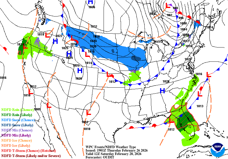
Forecast models are in increasing agreement that strong midlevel forcing will produce a narrow corridor of snow. The challenge is that these bands often shift north or south by a few counties before the event unfolds.
The National Weather Service Milwaukee/Sullivan notes, “Models remain in good agreement showing an area of strong warm air advection and frontogenesis around 700 mb on Saturday, which should produce a relatively narrow east/west band of snow.”
Forecasters caution that these setups are difficult to pin down precisely. The same discussion adds, “These situations are often tricky to pinpoint where the accumulating snow will set up, with north/south shifts likely in future model runs.”
Current projections suggest:
- Southern Wisconsin could see 1 to 3 inches where the band locks in.
- Central and east central Wisconsin have a 40 to 60 percent chance of light snow.
- Northern Wisconsin may see lighter totals due to drier air in place.
The National Weather Service La Crosse emphasizes the narrow nature of this system: “There are still slight disagreements on the placement of this band and given that this is a frontogenetic band, it will be quite narrow, just a few counties wide.”
Some ensemble guidance suggests localized totals higher than 3 inches are possible if the band intensifies. However, confidence in exact amounts remains moderate at best.
Sunday: Colder and Quieter
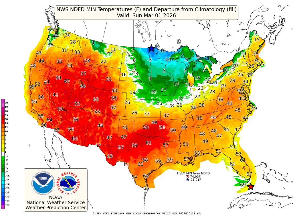
Behind Saturday’s departing system, colder air settles across the state.
High temperatures Sunday will generally top out in the mid-20s to low 30s. Breezy north winds may add a sharper feel to the day.
The National Weather Service Green Bay expects a quieter pattern to begin the new week, stating, “Quiet weather returns for Sunday and Monday as a strong arctic high pressure system builds into the Upper Midwest.”
There is a low confidence signal for light snow Sunday night into Monday in parts of southwest Wisconsin depending on the track of a developing Plains system, but most areas remain dry through Sunday.
As always in Wisconsin, small shifts in storm track can make a big difference, especially with narrow snow bands like Saturday’s setup.
Check back for updates as confidence increases on exact placement and snowfall totals.