
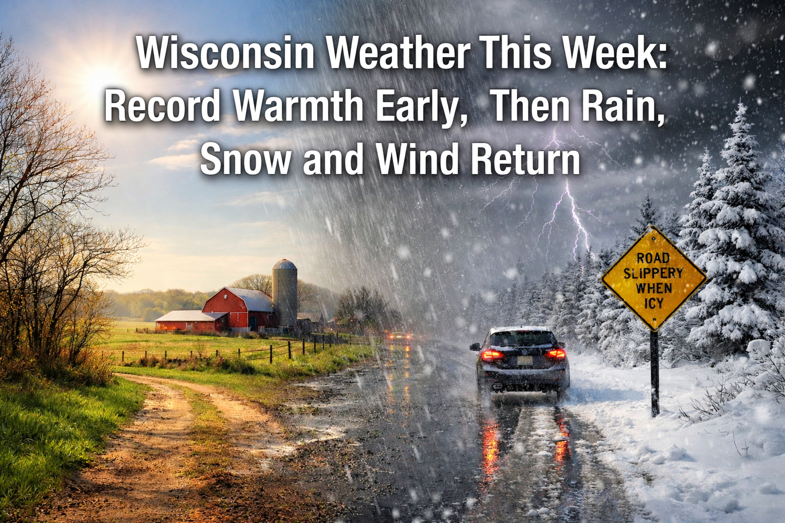
Wisconsin starts the week with near record warmth before a midweek storm brings rain, a wintry mix and possible snow across the region.
Warm Start Gives Way to Stormy Pattern Across Wisconsin This Week
Three Things To Know:
- Sunday and Monday: Unseasonably warm with highs in the 60s. Some areas could challenge record highs Monday.
- Tuesday into Wednesday: Widespread precipitation develops. Rain likely at first before changing to a wintry mix or snow in some areas.
- Late Week: Cooler with another system possible Thursday night into Friday bringing additional rain or snow.
Wisconsin will begin the week on an unusually warm note before a more active late winter pattern returns with rain, a wintry mix and potential snow by midweek.
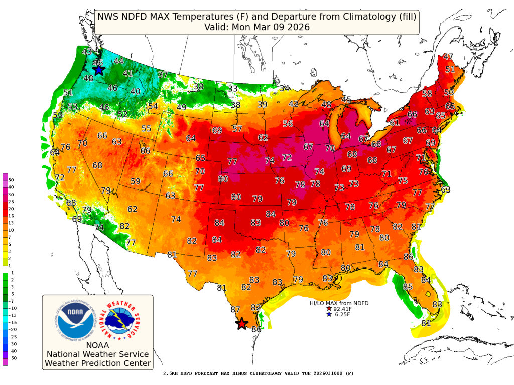
Southwest winds and warm air moving into the state will push temperatures well above normal Sunday and Monday. Many communities will reach the lower 60s Sunday, with even warmer air arriving Monday. Forecasters say some areas could reach the upper 60s and a few spots may approach 70 degrees Monday afternoon, putting record highs within reach.
That early spring preview will not last long.
A cold front sliding south late Monday will set the stage for a developing storm system that is expected to bring widespread precipitation to Wisconsin beginning Tuesday.
Rain Arrives Tuesday Before Changing to Wintry Mix
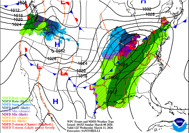
A strengthening low pressure system developing in the Plains will track toward the Great Lakes Tuesday into Wednesday. Moisture streaming north ahead of the system will bring increasing chances for rain across southern Wisconsin Tuesday, while northern areas may see mixed precipitation sooner.
Temperatures are expected to remain above freezing for much of Tuesday, supporting mostly rain early in the event. As colder air wraps into the system Tuesday night and Wednesday, precipitation may change over to a mix of rain, snow and possibly freezing rain.
Northern Wisconsin has the greatest chance of seeing accumulating snow. Forecast guidance suggests a moderate chance for a few inches of snow in parts of the state by Wednesday, along with periods of gusty winds that could create travel concerns.
Another System And Snow Possible Late Week
The unsettled pattern may continue after the midweek system moves out.
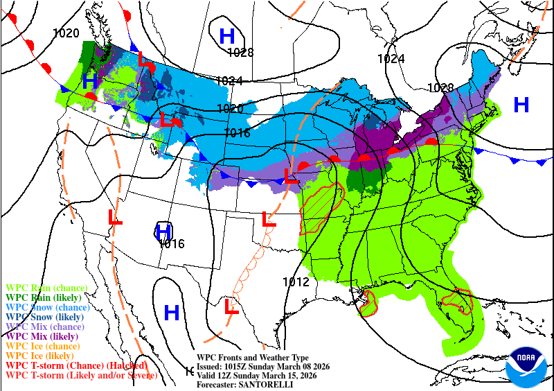
High pressure may briefly settle into the region Thursday, bringing near normal temperatures and quieter conditions. However, forecasters are already watching another disturbance that could bring additional rain or snow late Thursday into Friday, especially across northern Wisconsin.
With several systems moving through the Upper Midwest, Wisconsin’s weather will continue to swing between springlike warmth and late winter conditions through the end of the week.
Check our Forecast Page for updates.