

3 Things To Know:
- Severe thunderstorms are possible today with hail and gusty winds in the far northern Arrowhead.
- Cooling lake breezes will create a significant temperature difference between shore and inland areas on Wednesday.
- Hot, dry weather later in the week raises fire weather concerns across parts of the region.
Severe Tuesday Outlook
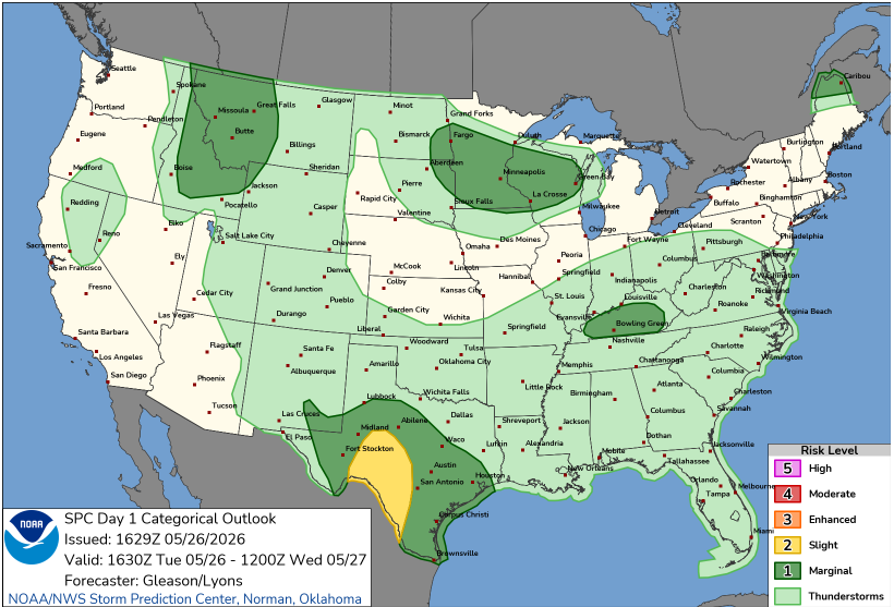
This afternoon, expect warm temperatures in the 80s as southerly winds meet a slow-moving cold front across Northwest Wisconsin. As we move into the evening, isolated to scattered thunderstorms are likely to develop, particularly south of the US Highway 2 corridor. While deep-layer wind shear is fairly weak, conditions are ripe for pulse-style storms that may produce hail up to half-dollar size along with wind gusts reaching 60 mph.
“Isolated severe thunderstorms are possible this afternoon and evening…” – NWS
As night falls, these storms are expected to diminish with a drop in temperatures, leading to lows in the upper 40s to mid 50s.
Wednesday’s Cool Down
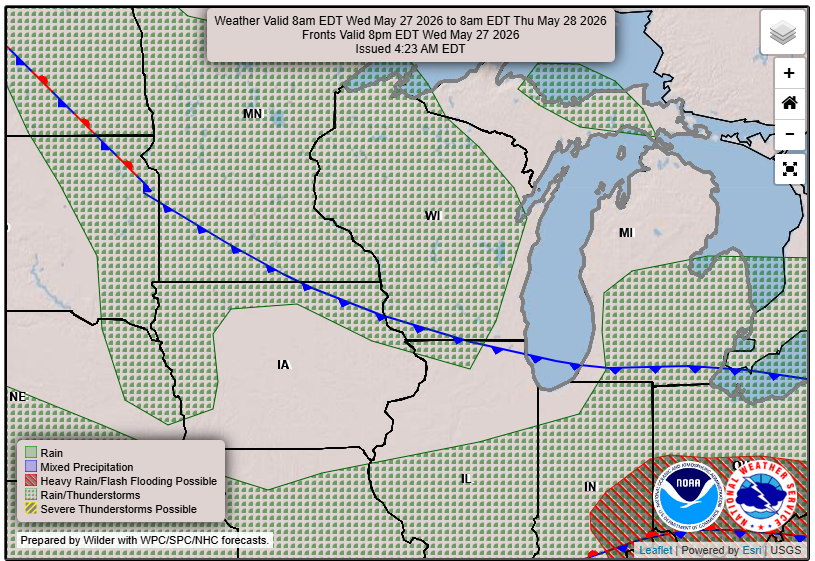
On Wednesday, a Canadian high pressure system will influence the area, creating an easterly wind that brings a noticeable coolness to regions near Lake Superior. Expect highs in the 60s and lower 70s near the lake, while inland areas will remain significantly warmer, reaching the 80s. Strong northeast winds up to 25 mph may lead to rough waves and increased rip current risks for those planning to swim.
Fire Weather Concerns Later This Week
As we head into late-week, conditions will dry out, with hot temperatures returning. By Friday, expect highs again in the upper 80s to lower 90s, potentially nearing record-breaking warmth. This weather pattern raises concerns for near-critical fire conditions, especially as humidity levels drop.
Prepare for continued warm and dry conditions into the weekend, with high pressure maintaining dominance. Stay safe and informed, especially if you plan any outdoor activities during this increasingly warm and dry stretch.
For updated forecasts where you live check out our Forecasts Page.
Source: NWS DLH Area Forecast Discussion, issued 2026-05-26T19:24:00+00:00.
