

3 Things To Know:
- A Beach Hazard Statement is in effect for high swim risk at local beaches.
- Expect light rain and sprinkles tonight, with increased chances for showers and storms Saturday evening.
- A warming trend is anticipated through the Memorial Day weekend.
Weather Overview
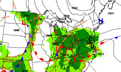
As we head into the holiday weekend in Southeast Wisconsin, keep an umbrella handy and stay updated on safety at our beaches. A developing low-pressure system is moving northeast into the Great Lakes region, bringing with it some chances for light rain.
Beach Conditions
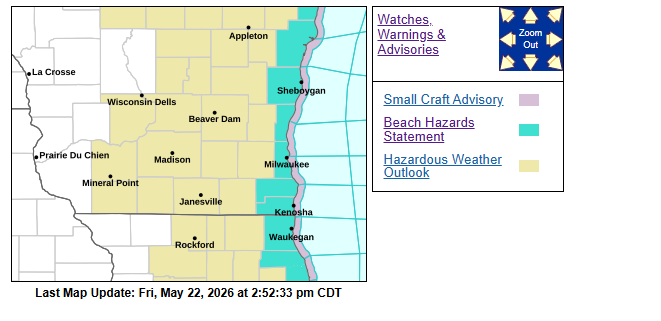
A Beach Hazard Statement is in effect for Milwaukee, Racine, and Kenosha Counties through late tonight due to elevated wave heights. The swim risk is expected to increase as waves reach 3 to 4 feet. This statement will also expand to include Sheboygan and Ozaukee Counties starting around 4 PM today. Despite earlier forecasts, waves are projected to remain below 5 feet, which is a slight relief.
Weekend Rain Showers At Times
Tonight, expect some sprinkles and very light rain, with chances estimated at 15 to 30%. The light rain or drizzle could linger into Saturday morning. Conditions will be mostly quiet during the Saturday afternoon hours, but we are monitoring a cold front moving across the region, which may bring isolated showers or weak storms later in the day. The best chances for rain are expected in the western parts of the state.
By Saturday night into Sunday morning, there is a better opportunity for precipitation in Southeast Wisconsin as another shortwave moves through. While some instability could spark a few rumbles of thunder, significant storms are not anticipated.
Warming Up
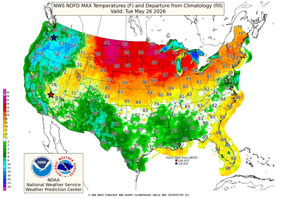
The weather is expected to clear out by Sunday afternoon, paving the way for a pleasant end to the Memorial Day weekend with drier air settling in. However, the early part of next week may bring additional weak chances for precipitation.
As the NWS notes, “The majority of this system will be well to the east of us, but parts of far eastern central and southeast WI may get some showers on the backside of the system as it pushes through.” This suggests the overall potential for significant rain is limited, but it’s always wise to stay prepared.
For updated forecasts where you live, check out our Forecasts Page.
Source: NWS MKX Area Forecast Discussion, issued 2026-05-22T18:29:00+00:00.
