
3 Things To Know:
- Widespread rain and scattered thunderstorms are likely Monday and Monday night.
- Mid to late week will bring hot and humid conditions, with potential for a Heat Advisory.
- Stay tuned for updates, as weather patterns may shift through the week.
Weather Overview
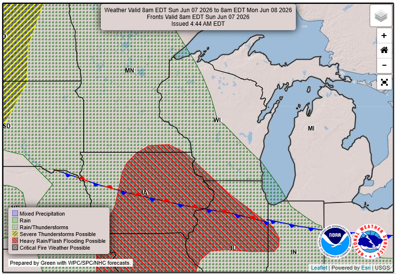
As we head into the new week, Southeast Wisconsin is bracing for a return to humid conditions. A low-pressure system is approaching, which is expected to bring widespread showers and scattered thunderstorms starting Monday morning.
What to Expect
Starting late Sunday and continuing into Monday, we’re likely to see more clouds and an increase in shower activity, particularly in southwestern Wisconsin. Rainfall amounts could exceed an inch due to high moisture levels in the atmosphere. Confidence in these rain chances is high, with models indicating a likelihood of at least some rainfall across much of the region.
“Overall precip chances are 85-95%, meaning it’s very likely nearly all areas in southern WI will see rain.” – NWS
By Tuesday, conditions will start to shift. We’re seeing lesser chances of precipitation as the week progresses, but expect temperatures to climb into the upper 80s to around 90°F, with the potential for some isolated showers late Tuesday night.
Mid-Week Heat
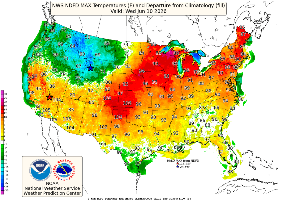
Wednesday looks to be the hottest day of the week, with high temperatures reaching the low 90s. This is coupled with a burst of instability in the atmosphere, increasing the possibility for afternoon thunderstorms. While these storms may initially develop to our west, some could drift into our region.
Looking Ahead
As we move into later in the week, anticipate a potential cooling trend as a longwave trough approaches from the west. Rain chances remain possible, particularly Thursday, though the timing and intensity of storms will be monitored closely as we approach.
Overall, expect a dynamic weather week in Southeast Wisconsin with significant humidity and temperature fluctuations, so stay informed!
For updated forecasts where you live check out our Forecasts Page.
Source: NWS MKX Area Forecast Discussion, issued 2026-06-07T10:47:00+00:00.