
3 Things To Know:
- Showers and severe storms will continue this evening, with total rain amounts of 1 to 2 inches expected.
- Warm and muggy conditions are forecast for Tuesday and Wednesday, with heat indices rising into the low 100s.
- Severe thunderstorms are likely on Wednesday afternoon and evening, with possible large hail and tornadoes.
Today’s Weather: Severe Storms
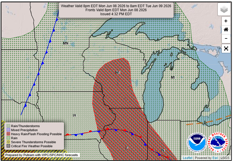
Western Wisconsin is currently experiencing showers and storms as a shortwave moves through the area. Rainfall amounts are expected to range from 1 to 2 inches, with localized pockets potentially receiving up to 4 inches. While the ground has been relatively dry, keep an eye out for possible flooding if storms train over the same areas. As noted in today’s forecast discussion, “much of southwest Wisconsin and central Wisconsin and portions of northeast Iowa are under a slight risk for excessive rainfall.” Expectations are for storms to move off to the northeast throughout the evening.
Forecast: Warm and Humid Conditions
After today, western Wisconsin can expect warm and muggy weather on Tuesday and Wednesday. On Tuesday, temperatures are forecast to reach the mid to upper 80s, with dewpoints in the upper 60s to low 70s leading to heat indices in the low 90s. Wednesday will bring even warmer highs in the upper 80s to low 90s, with heat indices potentially soaring into the mid-90s to low 100s. Rain and storms could impact temperatures throughout this period.
Severe Weather Outlook
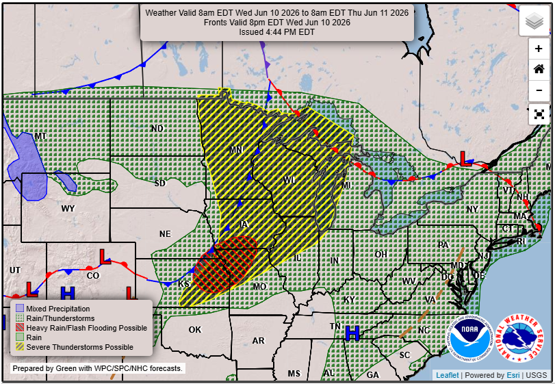
Severe weather is a growing concern for Wednesday afternoon and evening. A warm front is expected to lift into the region late Tuesday night, which could enhance storm development. Confidence is increasing for severe storms, including large hail and damaging winds. The National Weather Service has tagged the entire area in an Enhanced (level 3 of 5) risk for severe weather. The storms are anticipated to develop in the afternoon and could escalate into a more linear storm mode, posing increased risks.
Looking Ahead: Thursday’s Forecast
Following Wednesday’s storms, a cold front will pass through, bringing a slight dip in temperatures. However, there will be a conditional threat for severe weather on Thursday, particularly for northeast Iowa and southwest Wisconsin. Keep in mind that uncertainty remains about storm timing and intensity, and further updates will be provided as the situation evolves.
For updated forecasts where you live check out our Forecasts Page.
Source: NWS ARX Area Forecast Discussion, issued 2026-06-08T19:09:00+00:00.