

3 Things To Know:
- Storm chances this morning may bring damaging winds and large hail.
- Extreme heat indices exceeding 100 degrees expected Monday and Tuesday.
- Potential for storms returns Monday night into early Tuesday.
Morning Storms Possible
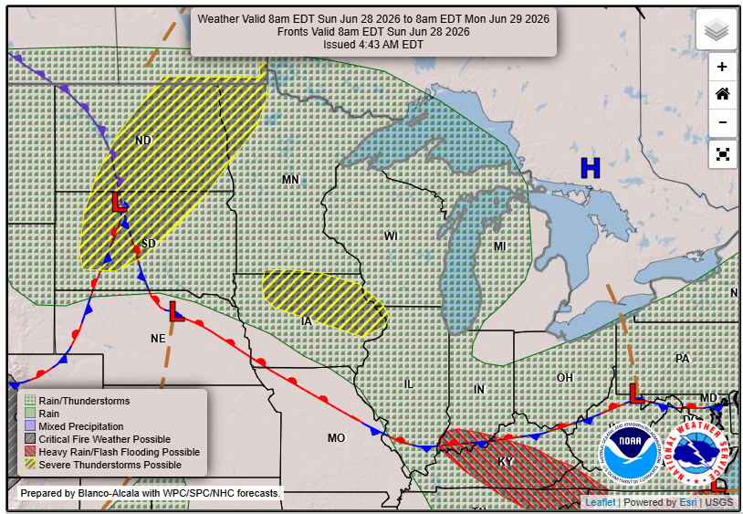
This morning, a line of storms is moving eastward across western Wisconsin. The main threats from these storms include large hail and damaging winds. As these storms progress through the region, the timing suggests they will reach the Upper Mississippi River Valley by mid-morning.
“Elevated storms will limit overall hazards to damaging winds and potentially very large hail should the northern edge of instability collocate with highest shear along the frontal boundary.”
Continued Storm Chances
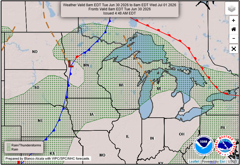
Storms may still be possible throughout the day, especially as the low-level moisture increases. The greatest chances of storms will be over the western, northern, and eastern counties during the afternoon and evening hours. Keep an eye on local developments as this situation unfolds.
Extreme Heat Ahead
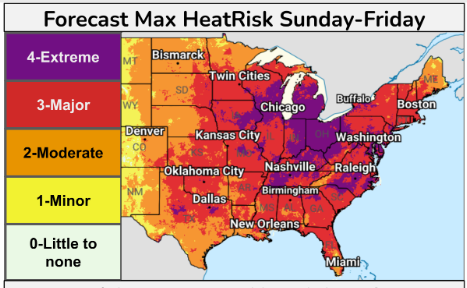
Looking ahead, prepare for a significant rise in temperatures starting Monday and extending through Tuesday, with heat indices expected to top 100 degrees. A brief respite may be on the horizon for Wednesday, but extreme heat is likely to return later in the week.
An Extreme Heat Warning is already in effect from 8 AM Monday to 8 AM CDT Tuesday for several counties in our area. Please take precautions during this period.
Final Thoughts
Stay aware of changing weather conditions, especially with storms moving through this morning and extreme heat approaching. For updated forecasts where you live check out our Forecasts Page.
Source: NWS ARX Area Forecast Discussion, issued 2026-06-28T06:12:00+00:00.
