

3 Things To Know:
- Expect 1-1.5 inches of rain along areas from Lake Michigan to the WI/IL border.
- High waves and dangerous currents at Lake Michigan beaches; stay away from the water.
- Next chance for thunderstorms arrives midweek, likely impacting Wednesday into Thursday.
Saturday Forecast
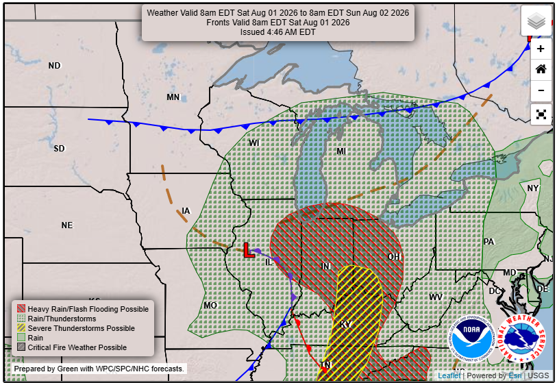
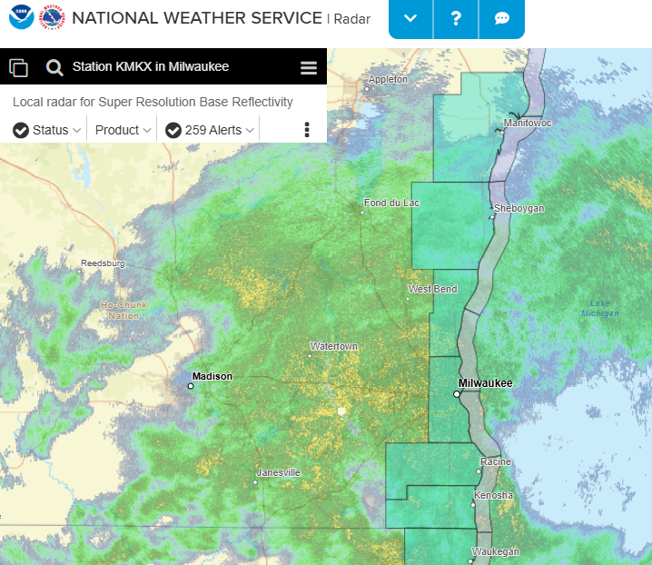
As we move through the early hours of Saturday, southeast Wisconsin is bracing for substantial rainfall. Areas along and south of I-94 can anticipate rainfall rates of up to 0.75 inches per hour. Light to moderate rain is expected across other regions, with totals ranging from 0.5 to 1 inch.
Rain will begin to taper off this afternoon. However, localized flooding is a possibility, especially in urban areas that could see several inches of rain in a short period. It’s important to note that flash flooding isn’t expected due to lower rainfall rates and currently dry soil conditions.
Coastal Hazards
In addition to the rain, breezy onshore winds will create high waves at Lake Michigan beaches, with some areas experiencing waves greater than 4 feet. A Beach Hazards Statement is in effect as conditions could pose a danger for swimmers through tonight. If you’re planning to head to the beach, it’s best to avoid the water and stay away from piers and breakwalls.
What to Expect This Weekend
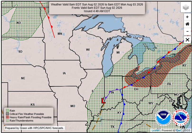
Once the rain diminishes this afternoon, it will lead to mainly dry conditions overnight into Sunday morning, with isolated showers possible along the Lake Michigan shoreline. Highs on Sunday are expected to remain in the low 70s near the lake, with warmer temperatures elsewhere in the region reaching into the upper 70s.
Looking ahead, as high pressure builds in early next week, expect lighter winds and pleasantly warm conditions, with highs in the upper 70s to low 80s by Tuesday. Watch for another round of thunderstorms midweek, especially from late Tuesday into Wednesday as a low pressure system moves through the area.
Conclusion
In summary, keep an eye on local forecasts, especially if you’re traveling or planning activities near water this weekend. The combination of rain and high waves may lead to challenging conditions.
For updated forecasts where you live check out our Forecasts Page.
Source: NWS MKX Area Forecast Discussion, issued 2026-08-01T06:21:00+00:00.
