

3 Things To Know:
- Showers and storms are returning later today, primarily affecting southern Wisconsin.
- Expect cooler temperatures today, with highs in the 70s, warming back up into the 80s early next week.
- Confidence in the timing and severity of storms remains low through the middle of the week.
As we move through today, keep an eye out for showers and thunderstorms, particularly in southern Wisconsin. The potential for severe weather remains but is uncertain; gusty winds and heavy rain may accompany any storm activity.
According to the latest forecast discussion, “the greatest opportunity for heavy rain and storms look to be later this morning.” However, the overall severe risk for northeast Wisconsin remains low due to capped conditions aloft.
Rain Chances and Storms This Week
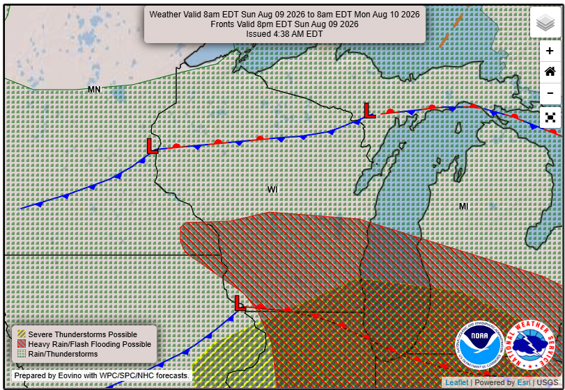
Additional rounds of showers and thunderstorms are expected into early next week. While the greatest chances will come on Monday night into Tuesday, confidence in when storms may develop is currently low. Any storms that occur are likely to be more prominent during the afternoon hours.
Temperature Outlook
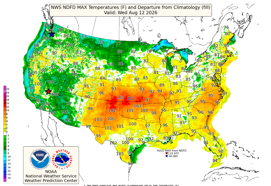
Today’s high temperatures will linger in the low 70s, but a warming trend will take place as we head into the early part of the week, with highs reaching the low 80s. By late next week, we anticipate a cool down, bringing temperatures back into the 70s.
As always, for updated forecasts where you live check out our Forecasts Page.
Source: NWS GRB Area Forecast Discussion, issued 2026-08-09T17:09:00+00:00.
