

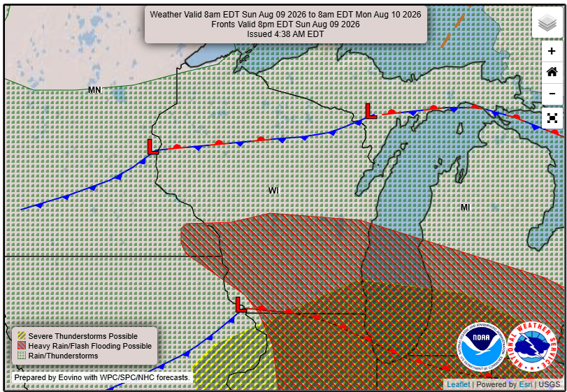
3 Things To Know:
- Showers and storms likely this morning and early afternoon, with a 70-90% chance of severe weather.
- Damaging wind gusts and locally heavy rainfall are the primary threats.
- Temperatures will remain seasonable, ranging from the upper 70s to middle 80s through mid-week.
Severe Outlook

This morning and early afternoon, Western Wisconsin can expect significant storm activity as a disturbance moves into the Upper Mississippi Valley. A warm, unstable air mass is developing, leading to a strong likelihood of thunderstorms. Areas south of I-90 are particularly at risk for severe circumstances.
As noted in the latest forecast discussion, “The primary threat with these storms would be damaging winds… with gusts approaching 70 mph possible.” An isolated tornado cannot be ruled out, although conditions make it less likely.
Evening and Overnight Thunderstorms
Later this evening, the chance for additional storms will rely heavily on how the earlier storms affect the atmosphere. There’s a possibility of recovery that could lead to more storm development. However, confidence is low due to the complex nature of the evolving weather system.
Looking Ahead: Monday to Wednesday More Thunderstorms

As we transition into the work week, more chances for showers and thunderstorms will occur through Monday and into Wednesday. The overall confidence in the specifics remains low, but conditions are favorable for severe storms, particularly on Monday evening. The threat of locally heavy rainfall could lead to flooding, should multiple rounds of storms occur in the same area.
Stay tuned for updates on storm developments as conditions can change quickly. For updated forecasts where you live check out our Forecasts Page.
Source: NWS ARX Area Forecast Discussion, issued 2026-08-09T11:19:00+00:00.
