

3 Things To Know:
- Thunderstorm chances return today, with a focus on a robust morning round.
- Localized flooding could occur due to heavy rainfall from storms.
- Additional chances for showers and thunderstorms persist into the first half of the week.
Overview
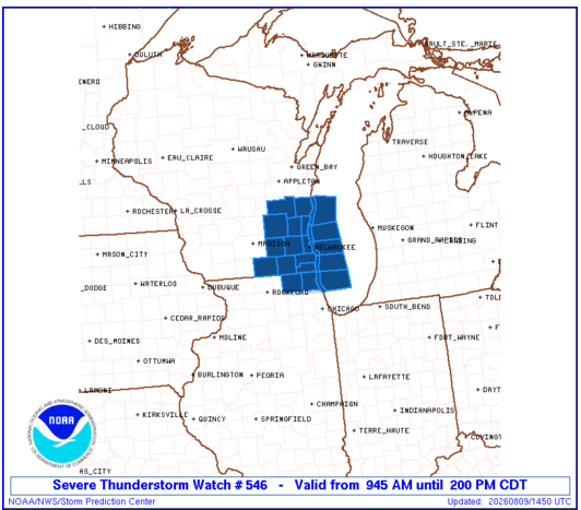
Today, Southeast Wisconsin is gearing up for a potentially active weather day as thunderstorms move into the area. The primary focus will be on the late morning into the afternoon when we can expect a significant round of storms. An evening round of storms could also develop, contingent upon how the midday weather plays out.
According to the National Weather Service, “Strong to severe storms will be possible,” particularly in the morning as instability builds from warm, moist air. This instability, coupled with bulk shear around 40 knots, creates an environment conducive for severe weather.
Morning and Afternoon Severe Storms
Current forecasts predict that organized thunderstorms will develop over Iowa and advance into our area by mid to late morning. Expect scattered showers and storms to precede this main event. Some models, like the HRRR, indicate that while the storms will be strong, they may weaken as they move east. However, there remains a risk of strong winds and even tornado potential, depending on how much instability we experience.
With a line of storms approaching, prepare for rainfall and gusty winds. Showers could linger into the early afternoon before moving out of the area.
Evening Severe Storms Possible
The potential for evening storms will depend on how much instability recovers after the morning activity. If instability builds sufficiently, additional thunderstorms could form along or south of the Wisconsin-Illinois border. Heavy rain will be a primary concern, with the possibility of localized flooding where storms repeatedly track.
Looking Ahead
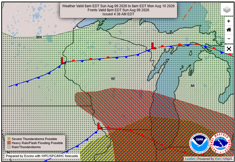
As we head into Monday and beyond, occasional showers and potential thunderstorms will linger in the area. The specific timing and strength of these systems will vary, but there is a high degree of uncertainty about the exact weather conditions.
So, it’s essential to stay informed throughout the day as conditions can change. Ensure you have a reliable way to get weather alerts and stay tuned for updates.
For updated forecasts where you live check out our Forecasts Page.
Source: NWS MKX Area Forecast Discussion, issued 2026-08-09T11:37:00+00:00.
