
Warm, humid air brings a reptative storm patter, heavy rain and possible flooding across Wisconsin this week. Here is a regional breakdown.
Southeast Wisconsin
Southwest Wisconsin
Central and Northeast Wisconsin
Northern Wisconsin
3-Things To Know
- Warm, humid air dominates with highs in the 60s to near 80 across Wisconsin
- Multiple rounds of showers and thunderstorms through the week, some severe
- Heavy rainfall may lead to rising rivers and localized flooding concerns
Wisconsin Weather Outlook: Active, Warm and Stormy Week Ahead
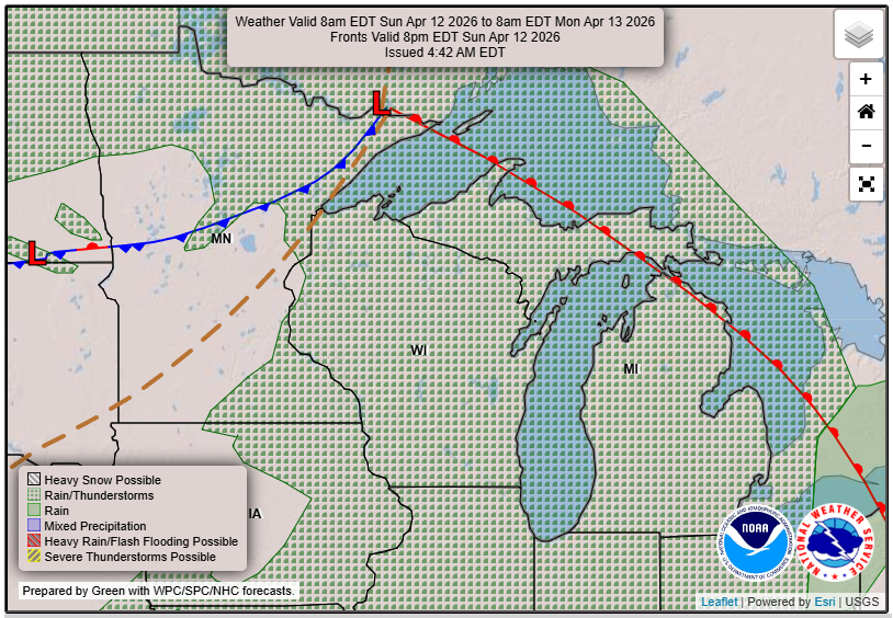
A very active spring pattern is setting up across Wisconsin this week, with repeated chances for showers and thunderstorms, unseasonably warm temperatures and increasing concerns about heavy rain and flooding.
“Multiple rounds of showers and storms are forecast from Tue-Sat, with a few inches or more of rain possible. River rises are expected with some flooding possible.”
The big picture is consistent statewide. Warm and humid air remains locked in place while a stalled front and passing systems trigger waves of storms through much of the week.
Southeast Wisconsin: Milwaukee, Madison and Along Lake Michigan
Southern and southeast Wisconsin, including Milwaukee and Madison, will sit near a stalled frontal boundary for much of the week. That means repeated storm chances and a higher risk for heavier rainfall totals.
Rain and storms will be on and off through midweek, with a few stronger storms possible at times. While not every day will be a washout, it will be difficult to find long stretches of dry weather.
Temperatures will feel more like late May than mid April, with highs pushing into the 70s and increasing humidity.
Near Lake Michigan, expect additional impacts including fog and gusty winds, especially early in the week.
Central and Northeast Wisconsin: Wausau, Stevens Point, Appleton, Green Bay
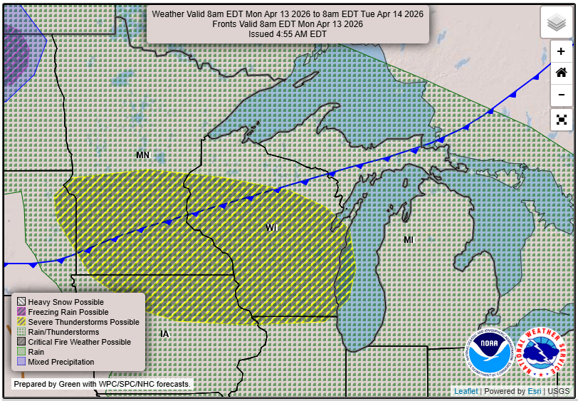
Central and east-central Wisconsin will be in a prime zone for both heavy rain and stronger storms, especially south of Highway 29, which includes cities like Wausau, Stevens Point and Appleton.
Rainfall totals through midweek could reach 1.5 to 2.5 inches, with localized amounts over 3 inches possible.
Strong to severe storms are most likely Monday evening, particularly south of a line from Tomahawk to Oconto to Algoma. Large hail and damaging winds are the main threats.
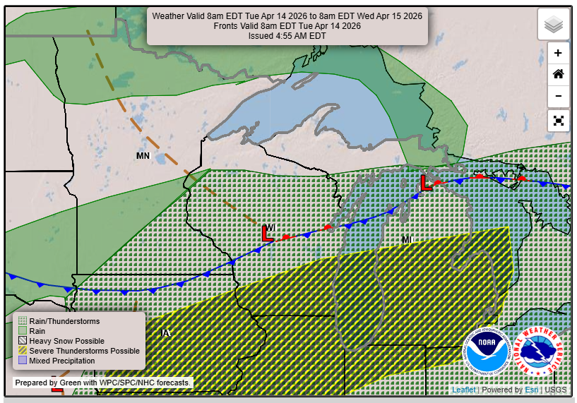
Flooding concerns are also increasing. The Wolf River is already experiencing minor flooding, and additional runoff could push rivers like the Menominee higher by mid to late week.
Southwest Wisconsin: La Crosse, Prairie du Chien, Wisconsin Dells
Southwest Wisconsin will see several rounds of storms, beginning early in the week and continuing into midweek.
La Crosse and surrounding areas could see a few stronger storms Monday evening if storms are able to develop along the warm front. If they do, all hazards including hail and damaging winds are possible.
Tuesday brings another potential round, with storms likely shifting into southern Wisconsin during the afternoon and evening.
Rainfall could be locally heavy at times, with some areas picking up one to two inches in a short period under stronger storms.
Temperatures will be notably warm, with highs reaching the 70s and even low 80s in some spots, well above normal for April.
Northern Wisconsin and the Northwoods: Rhinelander, Minocqua, Eagle River
Northern Wisconsin will also stay active, though the severe weather threat is a bit more conditional compared to areas farther south.
Storm chances increase early in the week, with the potential for stronger storms Monday and Tuesday depending on where the boundary sets up.
Rainfall combined with snowmelt will be a key concern across the Northwoods and near Lake Superior. This could lead to rising rivers and localized flooding issues, especially in areas with remaining snowpack.
Temperatures will vary more here, cooler near Lake Superior but still trending above normal overall.
The Bottom Line
This is a classic spring pattern for Wisconsin. Warm, humid air fuels multiple rounds of storms while a slow moving front keeps the region unsettled.
Not every day will be stormy from start to finish, but the overall trend favors frequent rain chances, occasional severe weather and increasing concerns about water levels.
The key things to watch this week are the timing of individual storm rounds, the potential for severe weather early in the week and how much total rainfall adds up by the weekend.
Check out our Forecasts Page for updates where you live!