
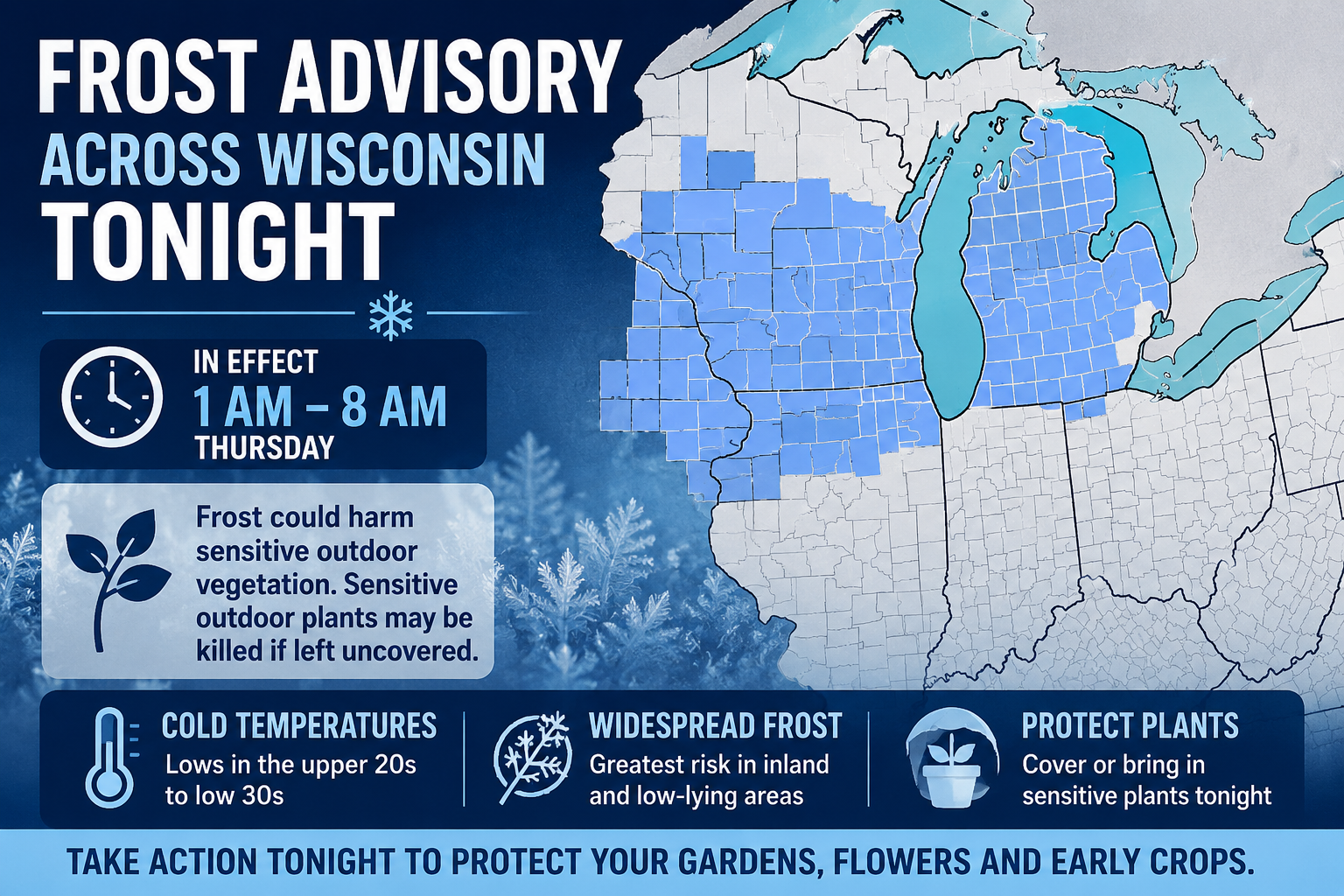
A Frost Advisory is in effect across Wisconsin tonight from 1 AM to 8 AM, with temperatures falling into the 20s and 30s. Here is what to expect and how to protect your plants.
3 Things To Know:
- Frost Advisory statewide from 1 AM to 8 AM Thursday with lows in the upper 20s to low 30s
- Widespread frost expected, with the coldest inland and rural areas at greatest risk
- Sensitive plants and early crops could be damaged or killed without protection
A large portion of Wisconsin is under a Frost Advisory tonight as temperatures fall back into the 20s and 30s, creating conditions favorable for widespread frost by early Thursday morning. The advisory runs from 1 AM through 8 AM and covers nearly the entire state, from central and northeast Wisconsin down through the Milwaukee metro and into southwest counties.
“Temperatures as low as 30 will result in frost formation.” – NWS
Gardeners and anyone with sensitive vegetation should take action this evening.

Southeast and South Central Wisconsin
This includes the Milwaukee metro, Madison, Waukesha County, and surrounding areas.
Temperatures are expected to drop to around 30 degrees overnight, especially in inland locations away from Lake Michigan. Urban centers like Milwaukee may stay slightly warmer, but widespread frost is still expected across suburbs and rural areas.
Communities impacted include Milwaukee, Madison, Waukesha, Racine, Kenosha, Janesville, and Beaver Dam.
Frost development will be most likely in low-lying areas and places that clear out overnight with lighter winds.
Central and Northeast Wisconsin
From Wisconsin Rapids and Stevens Point to Green Bay and Door County, conditions are even more favorable for frost formation.
Lows will fall into the lower to middle 30s, with some colder pockets dipping into the upper 20s.
“A few locations across central and east-central WI could drop into the upper 20s.” – NWS
Cities impacted include Green Bay, Appleton, Oshkosh, Wausau, and Sturgeon Bay.
The growing season has already begun in parts of this region, increasing the risk for damage to early-season crops and plants.
Western and Southwest Wisconsin
From La Crosse to Platteville and Prairie du Chien, colder air will settle in overnight with temperatures near or just below freezing.
Some locations could dip as low as 28 degrees, especially in valleys and sheltered rural areas.
Communities impacted include La Crosse, Viroqua, Richland Center, and Platteville.
This region has one of the higher risks for a more significant frost or even a light freeze in isolated spots.
North Central Wisconsin
Counties including Taylor, Clark, Jackson, and surrounding areas will also see temperatures fall into the upper 20s to near 30 degrees.
Frost will be widespread by early morning, especially in areas that decouple and clear overnight.
Timing and Impacts
The Frost Advisory is in effect from 1 AM to 8 AM Thursday statewide.
Impacts include:
- Damage or death to sensitive plants left uncovered
- Potential impacts to early crops and gardens
- Frost formation on exposed surfaces by sunrise
“Frost could harm sensitive outdoor vegetation. Sensitive outdoor plants may be killed if left uncovered.”
What You Should Do
- Cover or bring in sensitive plants tonight
- Protect early-season gardens and flowers
- Be aware of colder pockets in rural and low-lying areas
Looking Ahead
Frost chances may return again Thursday night into early Friday, especially east of the Mississippi River and inland from Lake Michigan.
This is a classic spring setback across Wisconsin, where mild days are followed by chilly, clear nights that allow temperatures to drop quickly after sunset.