
3 Things To Know:
- Temperatures will remain above normal with potential heat-related impacts.
- Expect widespread rain Monday into Tuesday
- Chance of severe weather later in the week.
Heat and Humidity Ahead
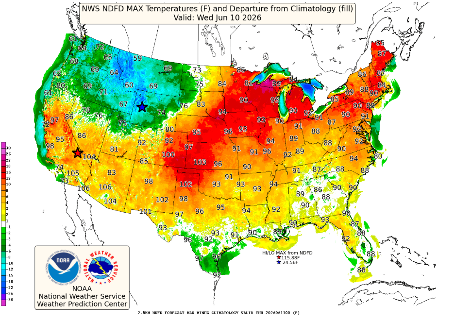
For the week ahead, temperatures are projected to remain significantly above normal. Expect highs in the 90s, combined with increasing humidity, which will likely result in moderate to major heat-related impacts. As stated in the forecast, “headlines will be necessary at some point during the middle of the week given widespread moderate (level 2) to major (level 3) risk for heat-related impacts.”
Rain and Storm Chances
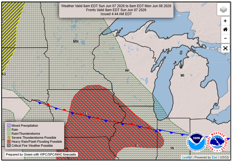
The next opportunity for widespread rain arrives Monday into Tuesday, with chances of 60 to 90% as a potent shortwave moves into the Midwest. This system brings the potential for heavy rainfall, especially in a moisture-rich environment. While organized thunderstorms are less likely, embedded thunder could still produce significant rainfall. The consensus among models indicates that we should be aware of rainfall amounts exceeding 1 inch in some areas.
Looking Ahead
As we move into the latter part of the week, the weather pattern is expected to become more active, with an emphasis on the potential for severe weather starting Wednesday. Current outlooks from the Storm Prediction Center already highlight the possibility of severe storms as conditions evolve.
Stay tuned for more updates as we approach these weather changes throughout the week.
For updated forecasts where you live check out our Forecasts Page.
Source: NWS GRB Area Forecast Discussion, issued 2026-06-07T11:30:00+00:00.